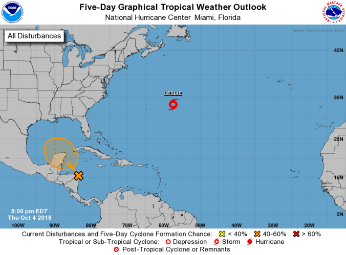
This system now has a 50-50 chance to develop further during the next five days, according to the National Hurricane Center.
HOLT, Fla., Oct. 4, 2018—The National Hurricane Center continues to watch the area of low pressure in the Caribbean Sea near the Honduran/Nicaraguan border.
Some slow development of this system is possible this weekend or early next week as the system drifts northwestward across the northwestern Caribbean Sea and the southern Gulf of Mexico, according to the NHC.
Although upper-level winds are not currently favorable for tropical cyclone formation, conditions are expected to change to allow a tropical depression to form by late this weekend or early next week.
The NHC gives this system a 50-50 chance of further formation during the five-day forecast period.
However, according to the National Weather Service in Mobile, there is a lot of uncertainty at this time and it is far too early to talk about a when, where and intensity.
This system will not impact Columbus Day weekend plans, according to the NWS in Mobile.
Meanwhile, Hurricane Leslie, located in the mid-Atlantic, has weakened to a tropical storm.
Maximum sustained winds have decreased to near 70 mph and continued gradual weakening is expected to occur during the next several days, according to the NHC.
Larger than previously reported, Leslie’s tropical-storm-force winds extend outward up to 290 miles from the center.
This is causing large swells generated by Leslie to continue to affect portions of the southeastern coast of the United States, Bermuda and the Bahamas during the next few days before shifting to the New England coasts toward the end of the week.
