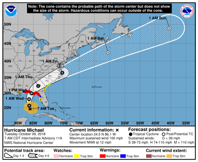
 HOLT, Fla., Oct. 9, 2018–The 7 a.m. storm track of Michael appeared to shift a little more to the east during the night hours moving this area further away from the hurricane.
Although still under a hurricane warning, the chances of either taking a direct hit or being inside the cone of probability has diminished here for now.
However, according to the National Hurricane Center, there is still unpredictability in this storm’s structure, intensity and direction, so a shift back to the west is possible with the next update.
The National Hurricane Center warns against focusing on the centerline of the hurricane track, but for now, landfall appears to be somewhere between Panama City and St. Joseph’s Bay just west of Apalachicola.
Destin, Niceville and Valparaiso are still in the probability cone; however, the storm appears to be trending east as it nears the Florida Gulf coast.
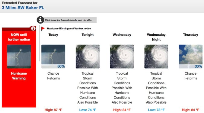
Today’s forecast calls for a 50 percent chance of thunderstorms. (National Weather Service in Mobile)
While potentially out of the hurricane’s path, rain with winds—at tropical-storm or hurricane-force strength—is in the National Weather Service’s forecast for this area beginning tonight and through Wednesday and Wednesday night.
The next complete NHC advisory will be at 10 a.m.
