 HOLT, Fla., Jan. 27, 2019—This area is in for an arctic blast Tuesday as temperatures drop and the wind chill makes it feel even colder.
According to the National Weather Service in Mobile, temperatures will plummet through the day Tuesday following the passage of a strong cold front.
The front will quickly move across the region late Monday night into Tuesday morning bringing much colder temperatures to the area through Tuesday night.
Precipitation in the form of a cold rain will develop across much of the region ahead of the cold front Monday night into Tuesday morning.
For forecast areas in the northwest, 1/2 to 1 inch of snow is possible.
Precipitation here will mainly be rain, although a brief mix of light snow flurries cannot be entirely ruled out Tuesday morning, according to the NWS; however, snow accumulation is not expected.
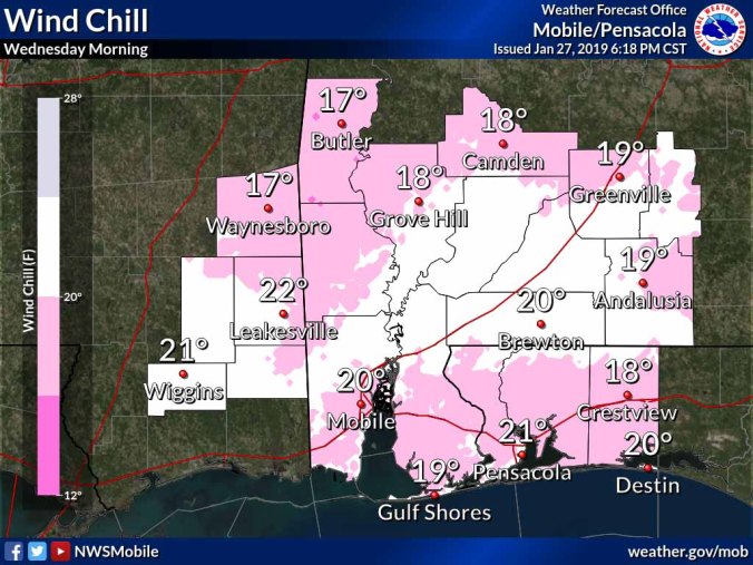 Temperatures by Tuesday afternoon will begin to drop and gusty northwest winds will cause the wind chill to plunge into the 20s and 30s during the day.
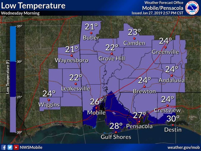
By Tuesday night, clearing skies will lead to bitter cold temperatures with lows ranging from low-to-mid 20s across much of the area.
Bitter cold temperatures will allow any residual moisture on roads, bridges and overpasses to re-freeze by Tuesday night causing slick spots to develop in the form of black ice.
Preparations to protect outdoor pets, sensitive vegetation and exposed plumbing is encouraged Tuesday, according to the NWS.
NWS forecast
