 HOLT, Fla., July 31, 2019—There are two tropical lows to watch as the 2019 hurricane season enters its historically busiest months tomorrow.
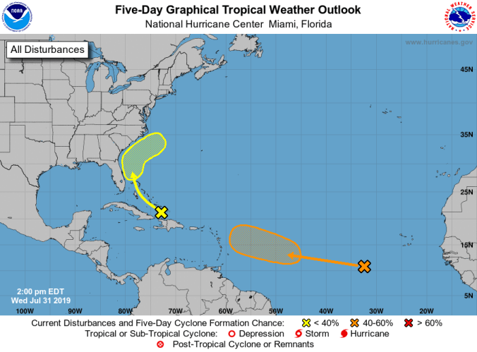
The Caribbean low-pressure system is producing an area of disturbed weather stretching from Puerto Rico to the southeastern Bahamas.
It’s still on track to move northwest-to-north during the next couple of days.
Conditions could become marginally conducive for development during the weekend while the system turns and accelerates northeastward off the southeast U.S. coast but it still has a low 10-percent chance of becoming a tropical cyclone during the next five days.
The other area of interest has improved its chance of further development.
The broad area of shower and thunderstorm activity over the far eastern Atlantic Ocean several hundred miles southwest of the Cabo Verde Islands now has a 60 percent chance of developing into a tropical depression or storm.
While little-to-no development of the wave is expected during the next few days, environmental conditions are forecast to become more favorable for development during the weekend and a tropical depression could form several hundred miles east of the Lesser Antilles by early next week.
Since the National Hurricane Center’s forecast doesn’t go beyond a five-day window, it’s still too early to forecast size, strength and direction.
The next tropical system to form will be named Chantal.
