 HOLT, Fla., Aug. 21, 2019–The low-pressure system identified by the National Hurricane Center last week formed into a tropical storm in the Atlantic last night.
Tropical Storm Chantal is moving east at 22 mph, but is expected to turn southwest Thursday and then south Friday.
For now, the NHC is forecasting the storm to become a depression by the weekend.
Chantal is the third named storm of the 2019 hurricane season. The next named storm will be called Dorian.
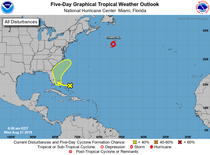 Closer to the United States, an area of disturbed weather is located over the central and northwestern Bahamas.
Some slow development is possible during the next several days as it moves toward the Florida peninsula and southeastern U.S., according to the NHC.
Formation chance during the five-day forecast is 20 percent.
Aug. 20 through Sept. 10 is considered climactically the most active period of the Atlantic hurricane season.
National Hurricane Center forecast
