Rain moves back into the forecast beginning today with an increase of possible severe storms tomorrow night into Wednesday. (National Weather Service)
HOLT, Fla., March 2, 2020—Another round of possible severe weather is in the forecast for this week beginning tomorrow.
According to the National Weather Service, heavy rainfall is expected across the Florida panhandle with showers increasing Tuesday as a cold front heads south.

This area can expect a slight risk of severe storms with damaging wind gusts and hail the primary threats. (NWS)
Damaging wind gusts, large hail and brief tornadoes are all possible with wind and hail being the primary threats.
While the majority of the heavier rain will be concentrated north of this area, thunderstorms will be possible across the forecast area, according to the NWS.
Widespread total rainfall amounts are forecast to range from 2.5-to-4 inches with localized higher amounts of 4-to-6 inches possible.
The best chance of strong-to-severe thunderstorm activity is expected Wednesday.
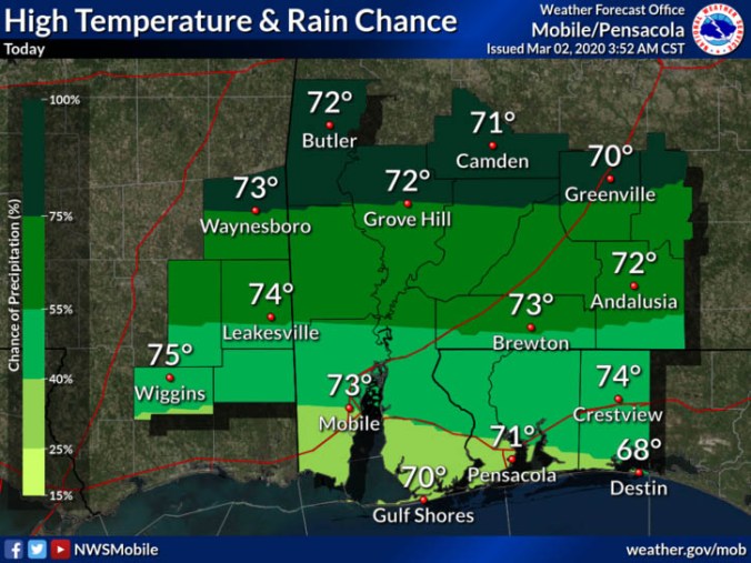
Winds will pick up today to around 10-to-15 mph with possible gusts up to 25 mph. High temperature is expected around 73 today and 77 tomorrow.
