 HOLT, Fla., April 10, 2020—The National Weather Service in Mobile continues to fine tune the severe weather forecast for Easter Sunday.
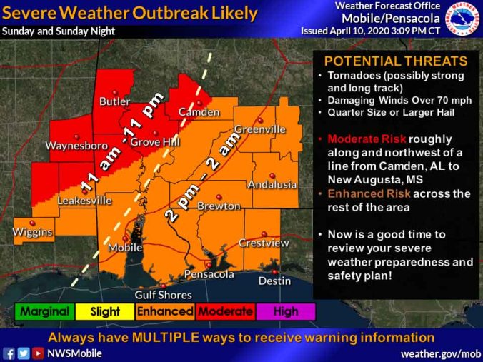
While little has changed from the 5 a.m. forecast, the 3 p.m. update indicates timing for this system to be Sunday afternoon into early Monday morning.
The stronger storm activity appears to be along and north of a New Augusta, Miss., Grove Hill-to-Camden, Ala., line.
The main threats with this system are tornadoes, some of which could be strong (EF2+) and long-tracked, damaging straight-line winds in excess of 70 mph and large hail.
Other impacts will be strong and gusty winds ahead of the storms during the day Sunday.
The forecast will continue to become better detailed throughout the weekend.
The NWS recommends having multiple ways to receive storm warnings such as radio, TV, cell phone alerts, social media and weather radio.
NWS Mobile forecast
