HOLT, Fla., Aug. 21, 2020—The National Hurricane Center is watching two tropical systems forecast to enter the Gulf of Mexico.
They are expected to strengthen into hurricanes early next week as they make their way toward the Gulf Coast.
Tropical Storm Laura
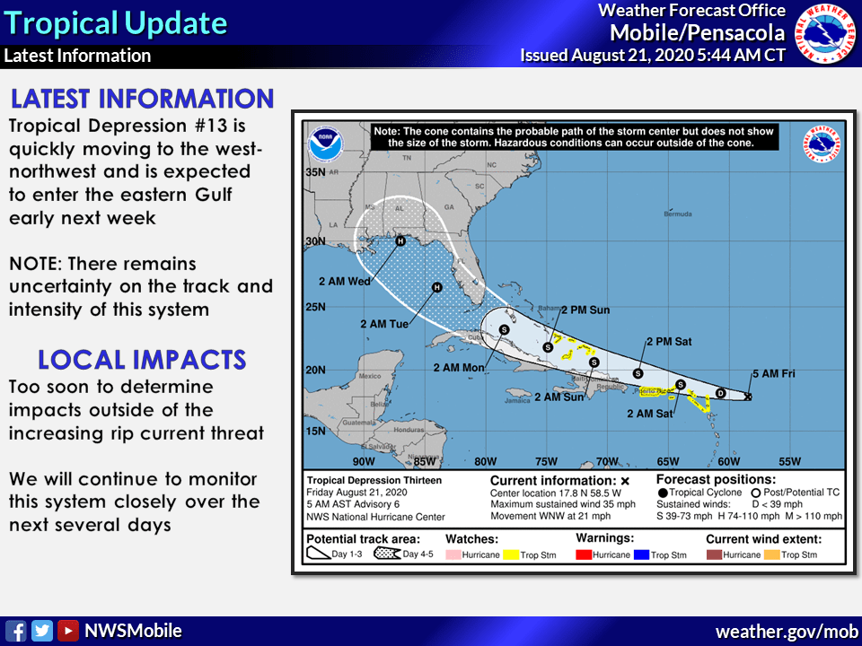
Data from a Hurricane Hunter mission found Tropical Depression 13 has strengthened into Tropical Storm Laura.
Laura is located about 300 miles east of the Leeward Islands moving west-northwest at 21 mph.
The storm is expected to move near or north of the northern Leeward Islands later today, near or north of the Virgin Islands and Puerto Rico Saturday and near or north of Hispaniola Saturday night.
The current track brings this system into the eastern Gulf as a hurricane early next week.
The NHC is predicting Laura to strengthen into a hurricane Monday night or Tuesday.
However, there remains too much uncertainty at this point to pin down potential local impacts, according to the National Weather Service in Mobile.
Details of the long-range track and intensity forecasts are more uncertain than usual since the system could move over portions of the Greater Antilles this weekend affecting the system’s ability to strengthen, according to the NHC.
For now, development possibilities range from the system degenerating to an open wave to a major hurricane.
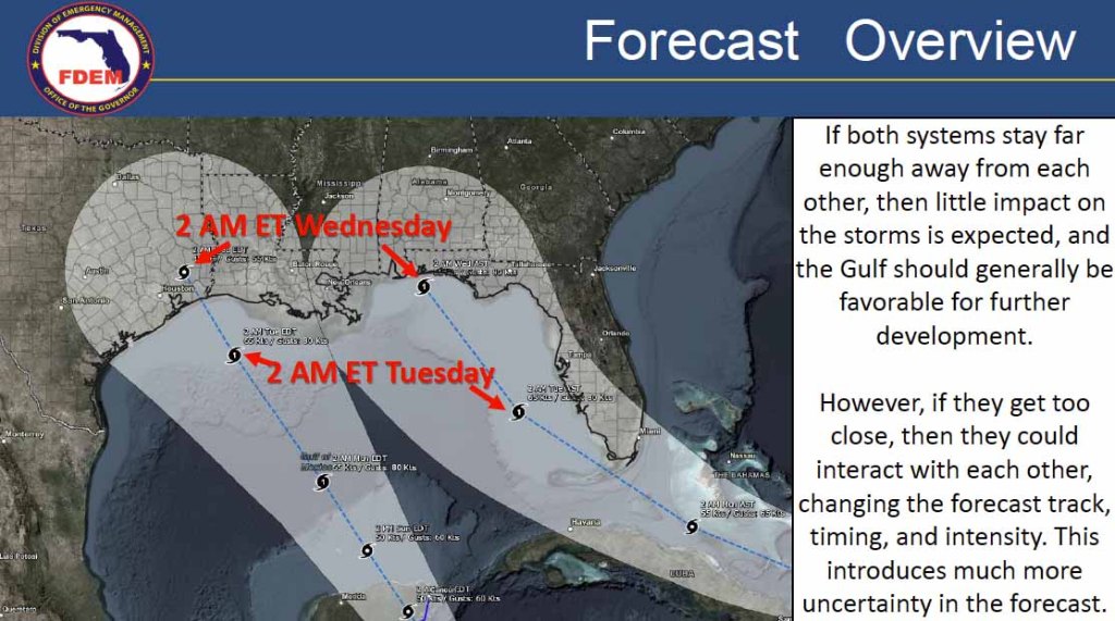
Once in the Gulf of Mexico, upper-level winds should be generally favorable for development if the storm doesn’t get too close to Tropical Depression Fourteen, according to the NHC.
Laura may interact with TD 14, which is also forecast to be in the Gulf by that time, resulting in both storms turning toward the northwest or north-northwest.
Tropical Depression 14
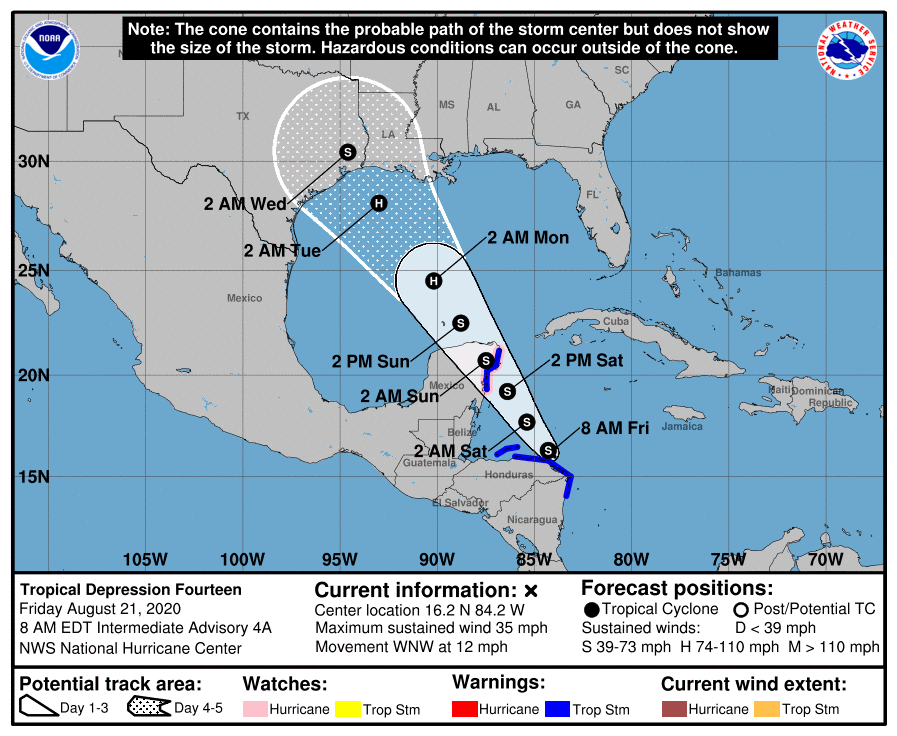
The center of TD 14 is located 30 miles north-northwest of the Nicaragua-Honduras border moving west-northwest at 12 mph.
This system is expected to become Tropical Storm Marco later today and be near hurricane strength tomorrow, according to the NHC.
TD 14 is forecast to make landfall on the Yucatan Peninsula tomorrow, emerge into the Gulf Sunday and make a second landfall in Texas or Louisiana Tuesday.
However, this forecast track is uncertain due to the interaction with TS Laura.
When storms collide
When two hurricanes pass close enough to each other, they begin an intense dance around their common center, according to the National Weather Service.
This is known as the Fujiwhara Effect.
The weaker hurricane will orbit around the stronger one and eventually crash into its vortex and be absorbed.
Two storms closer in strength can gravitate toward each other until they reach a common point and either merge or continue to spin around each other before shooting off on their own paths.
The possibility of this effect happening in the Gulf with TS Laura and TD 14 is making it difficult for the NHC to determine the intensity and track of these storms, explaining some of the reasons for the uncertainty in the forecast.
Staff and NHC forecasts
