
HOLT, Fla., Feb. 14, 2021—There’s a threat for severe thunderstorms in this area Monday afternoon into Monday evening.
The primary hazards will be damaging winds and an isolated tornado as a front moves through the area, according to the National Weather Service in Mobile.
An east wind will shift to the west with gusts as high as 25 mph.
Temperatures behind the front will drop quickly into the upper 20s Monday evening into Tuesday morning with the possibility of black ice developing on wet area roads.
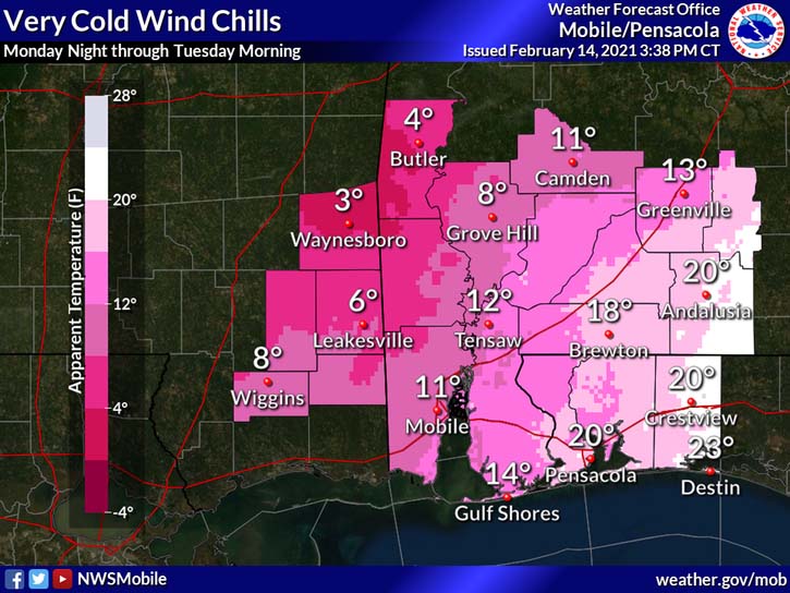
Very cold temperatures Monday night combined with brisk northwest winds around 10 mph and 20 mph gusts will result in dangerously cold wind chill values, according to the NWS. Areas west of Interstate 65 will see single-digit wind chill temps.
Tuesday will be mostly sunny with a high near 49 degrees and wind chill values between 20 and 30 degrees early in the day.
