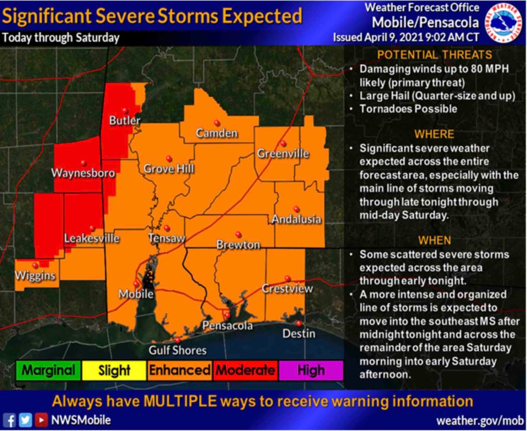
HOLT, Fla., April 9, 2021—The severe weather risk for this area has been elevated to a level 3 by the National Weather Center.
Primary threats are damaging winds and large hail.
Two rounds of severe weather are expected today and going into Saturday.
Scattered thunderstorms are likely across the area today as the atmosphere becomes unstable with some storms likely becoming strong to severe.
Large hail, up to quarter-sized, will be the primary threat with damaging wind gusts possible with any storm that develops.
For the second round of storms, a significant squall line of thunderstorms is expected to race across the forecast area well after midnight into midday Sunday, bringing severe weather to most of the forecast area.
Primary threat will again be widespread damaging straight-line wind gusts that could reach 80 mph, with golf ball or larger sized hail. The potential for embedded tornadoes is also a possibility, according to the NWS.
Ahead of the squall line, supercell thunderstorms may form and become severe.
Widespread rainfall could bring 2-to-4 inches, with some localized amounts up to 8 inches possible.
