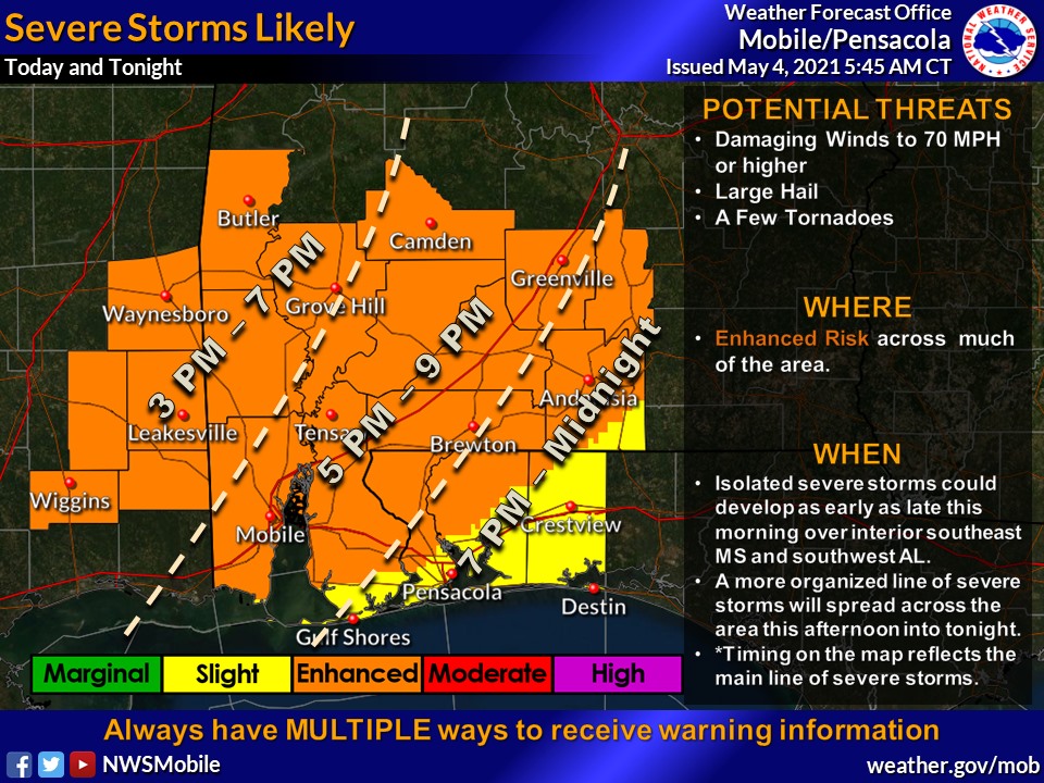
HOLT, Fla., May 4, 2021—The threat for severe weather today is increasing according to the National Weather Service.
This area is now in a level 2 (out of 5) severe storm threat risk due to a moist and unstable airmass in place across the region through Wednesday morning.
Timing of severe weather for this area is this evening through midnight.
Gusty southerly winds of 15-to-25 mph with occasional gusts higher than 30 mph is forecast to develop today ahead of the approaching system.
An organized line of strong-to-severe thunderstorms will spread across the area this afternoon into tonight likely capable of producing damaging winds, torrential rain, large hail and a few tornadoes, according to the NWS.
The primary threat is damaging winds of 70 mph or higher along the frontal line as it moves across the area, according to the weather service.
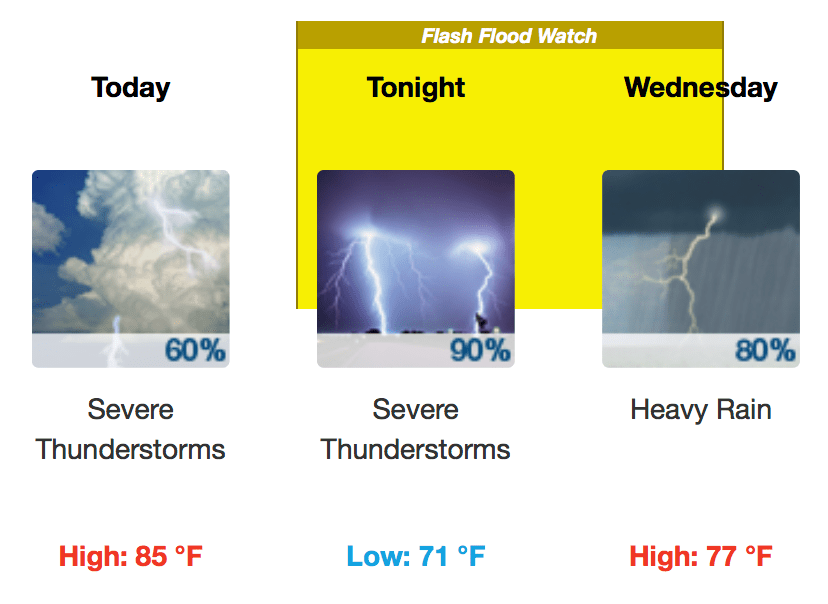
A second round of showers and thunderstorms developing late tonight into tomorrow morning along a stalled frontal boundary will also have a potential of producing torrential rainfall over a short period of time.
In addition to severe storms, there is an elevated-to-significant threat of flooding rains this afternoon and perhaps continuing into early afternoon tomorrow.
Torrential downpours with rainfall amounts of 2-to-4 inches with localized totals of at least 6-to-8 inches is possible, leading to an increasing flash flooding threat, according to the NWS.
A flash flood watch is now in effect from this evening through tomorrow afternoon.
National Weather Service forecast
