HOLT, Fla., June 18, 2021—Areas of the northwest Florida panhandle are now under a tropical storm warning.
The warning area was extended from the Florid/Alabama state line east to the Okaloosa/Walton county line.
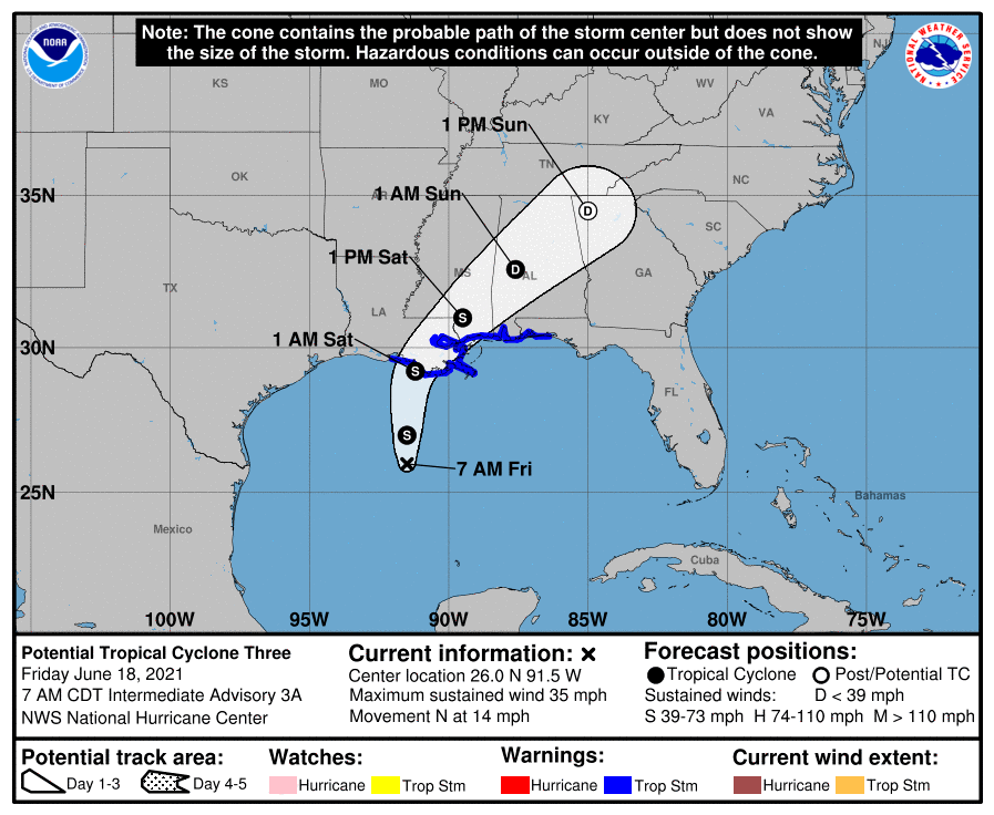
Tropical storm conditions are expected to begin today in areas well east of the center of Potential Tropical Cyclone Three, according to the National Hurricane Center.
Additionally, a wind advisory will be in effect beginning at 10 p.m. tonight through 1 a.m. Sunday.
A flash flood watch is also in effect beginning at noon today through 6 a.m. Sunday.
According to the NHC, PTC 3 is becoming better organized, but still doesn’t have a well-defined center. However, it is forecast to strengthen into Tropical Storm Claudette before landfall.
A strong band of heavy rain and tropical-storm-force winds are expected to persist on the southern side of the storm after landfall.
Area effects of the storm
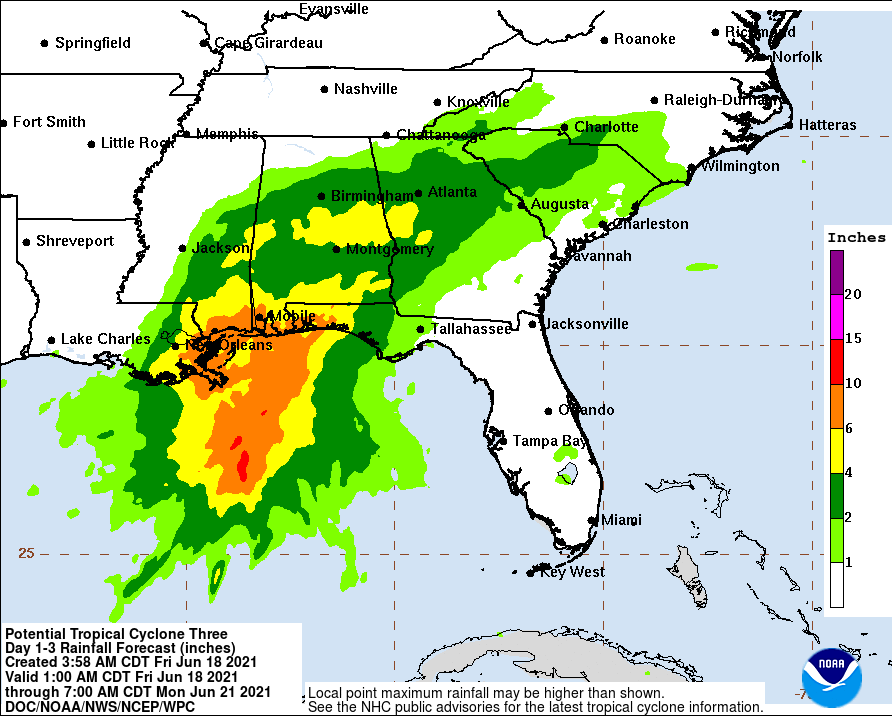
The system is expected to produce heavy rainfall, considerable flash, urban and small stream flooding beginning today and continuing through the weekend, according to the National Weather Service in Mobile.
In addition to heavy rainfall, gusty winds are likely with 20-to-30 mph winds gusting to 40 mph expected.
Additionally, small brief tornadoes are expected in association with the rain bands moving onshore beginning this evening, lasting through Saturday morning.
The system is moving north near 14 mph with maximum sustained winds near 35 mph.

