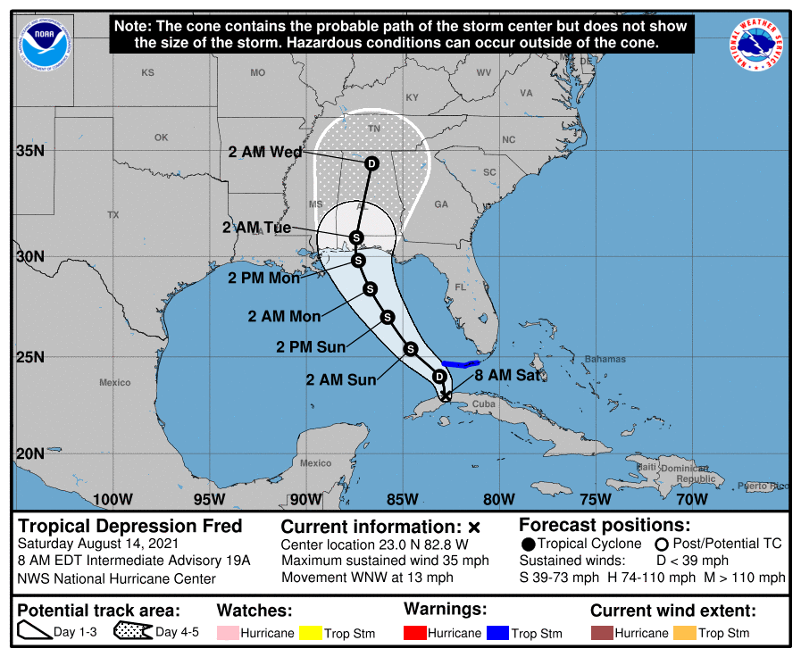

HOLT, Fla., Aug. 14, 2021—The National Hurricane Center’s forecast track for Fred continues to nudge west putting northwest Florida east of the storm.
An asymmetrical system, most of Fred’s weather is on the east side of the system, meaning this area will likely take the brunt of the storm. How much of an impact depends on location and storm intensity at landfall.
While Fred’s travels over Cuba have disrupted the system’s circulation to the point it may be a tropical wave this morning, the system is expected to re-strengthen as it moves into the southeastern Gulf of Mexico.
Although very disorganized now, forecast models show Fred’s circulation becoming better defined tonight or tomorrow and slow strengthening is forecast for the system to regain tropical storm strength.
However, according to the NHC, significant intensification seems unlikely due to southern wind shear increasing before Fred reaches the coast.
Fred is expected to pass west of the lower Florida Keys this afternoon and move across the eastern Gulf of Mexico tonight through Monday.
Landfall is forecast Monday night or early Tuesday along the western Florida panhandle or the Alabama coast.
