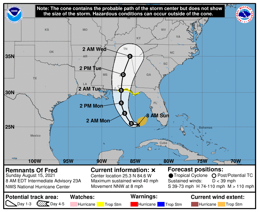
HOLT, Fla., Aug. 15, 2021—The remnants of Fred have re-developed into a tropical storm and tropical storm warnings will be issued for the northern Gulf coast at the 11 a.m. National Hurricane Center update.
A tropical storm watch was issued at the 5 a.m. update for the northwest Florida panhandle from the Florida/Alabama state line to the Big Bend area.
The National Hurricane Center’s 8 a.m. track update places Pensacola dead center of the cone.
Traveling north-northwest, Fred is forecast to turn north tomorrow and make landfall tomorrow night or early Tuesday, according to the NHC.
For now, Fred’s upper wind intensity is forecast at 50 mph before landfall, dropping to 35 mph after it moves over land.
Impacts from the storm include heavy rain, wind and tornadoes. The outer bands of Fred are likely to begin reaching this area sometime tomorrow.
