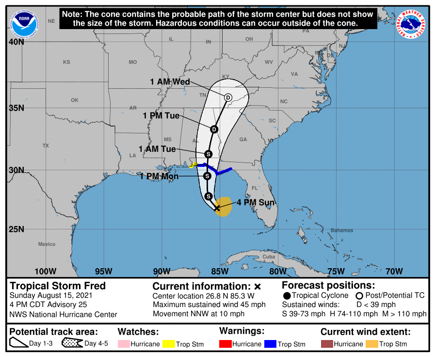
HOLT, Fla., Aug. 15, 2021—The National Hurricane Center moved Tropical Storm Fred’s cone of uncertainty further east with its 4 p.m. forecast update.
Landfall looks to be in Walton County tomorrow afternoon or evening; however, that could shift either way in future updates, according to the NHC.
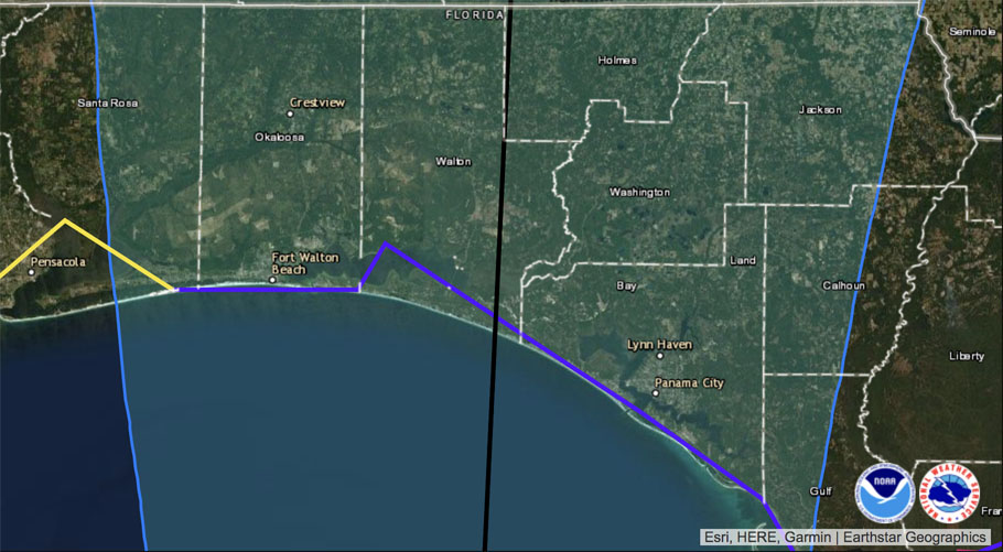
Tropical storm warnings remain in effect for coastal areas in Okaloosa and Walton counties. Santa Rosa and Escambia are under tropical storm watches.
This area is under a flash flood watch beginning at 8 p.m. tonight until 2 p.m. Tuesday.

Almost all of Fred’s energy is to the east of the center of the storm. Tropical storm force winds extend outward up to 90 miles, mainly to the east.
Forecast strength as the storm approaches the coast is 60 mph winds, quickly weakening to 40 mph after making landfall, according to the NHC.
Impacts from Fred include wind, rain and a tornado or two along the west coast of Florida and over the Florida panhandle.
Tropical Storm Grace
Tropical Storm Grace has weakened to a depression, but is forecast to regain strength possibly tonight or tomorrow morning.
The forecast track is for Grace to move over the mountainous regions of Hispaniola and Cuba.
Once in the Gulf, the NHC expects Grace to regain some strength.
Invest 96
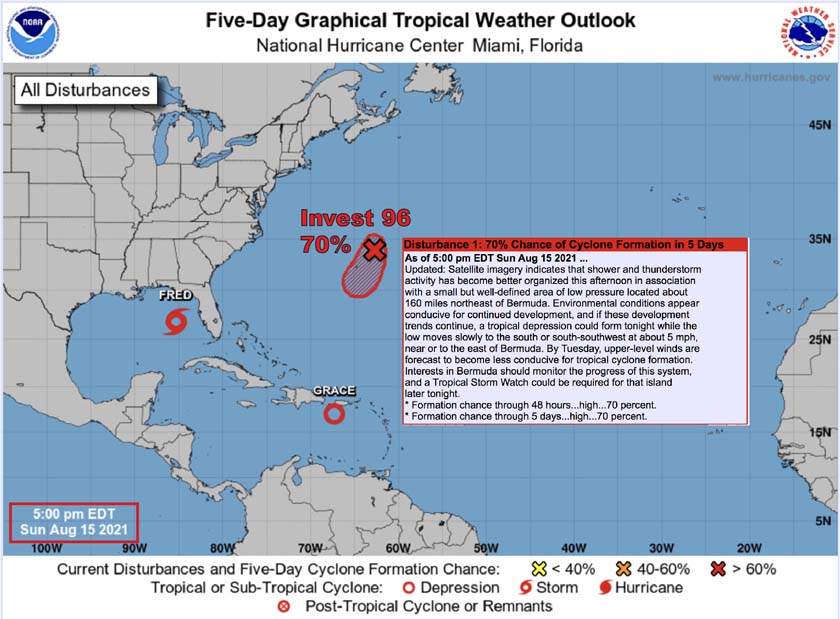
Invest 96, located about 160 miles northeast of Bermuda, is wandering around in the Atlantic.
The NHC says conditions are favorable for development and a tropical depression could form tonight while the low moves slowly south to southwest.
However, by Tuesday, conditions become less favorable for tropical storm formation, according to the NHC.
