HOLT, Fla., March 8, 2022—There is increasing potential for strong-to-severe storms late tonight into early tomorrow morning ahead of a cold front passing through the area.
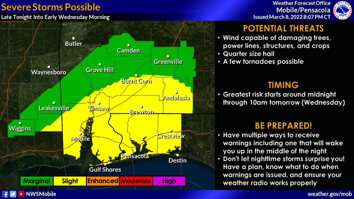
The National Weather Service’s Storm Prediction Center upgraded this area, placing it in a level 2 out of 5 risk for severe weather.
This includes all of Okaloosa, Santa Rosa and Escambia counties as well as parts of southern Alabama.
Strong-to-severe thunderstorms are possible with the greatest risk beginning around midnight and continuing through mid-morning tomorrow, according to the NWC.
Timing for this area is around 4-9 a.m. tomorrow. Counties to the west of Okaloosa could see severe weather between 1-6 a.m. tomorrow.
Storms will be capable of producing damaging wind gusts, quarter-size hail and a few tornadoes.
Rain chances will decrease throughout the day tomorrow as the cold front passes through.
A second, stronger cold front will pass through the area Friday, bringing another round of showers and thunderstorms.
Lows Friday night will be in the low 40s. Saturday will be sunny and breezy with a high in the low 50s.
Saturday night’s temps will plunge into the upper 20s with temps in the mid-30s Sunday night.
