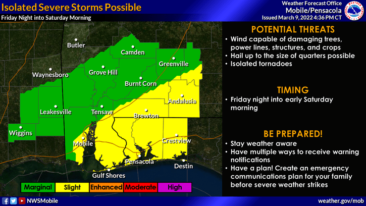
HOLT, Fla., March 9, 2022—Another round of severe storms is possible Friday night.
A stronger cold front is forecast to move through the area Friday night into Saturday morning with a chance of strong-to-severe thunderstorms mainly east and south of the Interstate 65 corridor, according to the National Weather Service.
A much colder airmass will move into the area behind the frontal boundary bringing freezing temperatures by Saturday night.
In the meantime, rain continues through the day today, increasing to 80 percent tonight.
Rain will continue through the morning tomorrow, but skies should become mostly sunny by the afternoon with a high of 74 degrees.
Friday’s forecast is rain with a 70 percent chance during the day, increasing to 80 percent during the overnight hours.
Saturday will be sunny and breezy with 15-20 mph winds and gusts up to 30 mph.
Temps will plunge to the high 20s overnight to a low of 27 degrees. Sunday’s high will be in the high 50s.
Mobile tornado
A preliminary report by the NWS determined an EF-1 tornado touched down in Mobile County around 12:45 a.m. this morning resulting in minor tree damage, snapping a few trees in its path.
The most significant structural damage was to a residential roof.
With a width of 50 yards, the tornado traveled for 1.77 miles on the ground.
An EF-1 tornado is considered a weak storm with 86-110 mph winds.
