HOLT, Fla., March 4, 2022—Another round of severe weather is in the forecast for tomorrow through Wednesday.
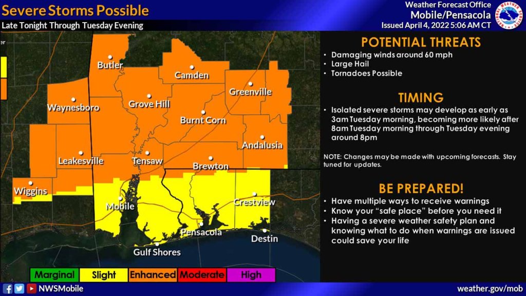
According to the National Weather Center’s Storm Prediction Center, the potential for strong-to-severe storms increases late tonight setting up a level 2 risk for this area tomorrow. Areas north of Florida are under a level 3 storm risk.
Storms may develop as early as 3 a.m. with the most active period taking place during the day tomorrow between 8 a.m. to 8 p.m., according to the NWS in Mobile.
Developing storms will be capable of producing damaging winds around 60 mph, golf-ball-sized hail and tornadoes along with heavy rains through the afternoon hours.
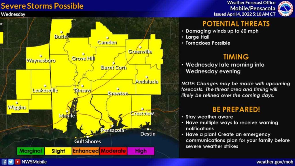
Wednesday, a strong cold front will approach the region bringing another possible round of strong-to-severe storms, according to the NWS.
Storms may develop in the late morning through evening hours before the front pushes through by Wednesday night.
As with tomorrow’s storms, primary hazards with this threat include damaging winds and large hail, with the possibility of a few tornadoes, according to the NWS.
Heavy rainfall associated with these storms could bring another 2-4 inches with locally higher amounts.
National Weather Service forecast
