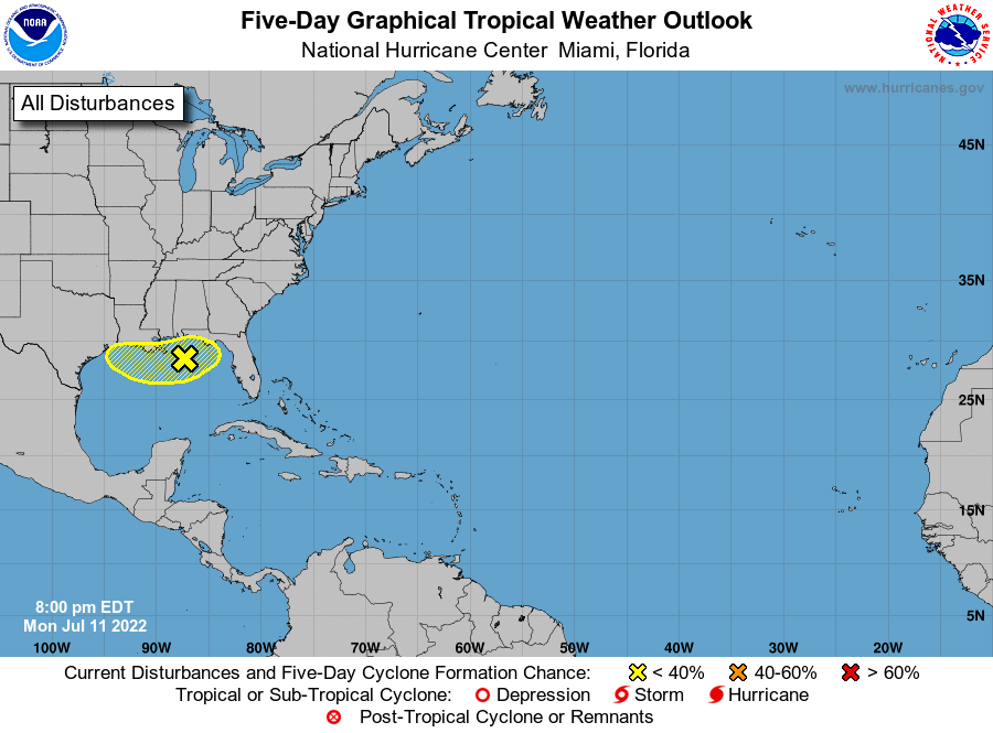
HOLT, Fla., July 11, 2022—Heavy rains are possible for the next several days from the Florida panhandle to Louisiana due to a low pressure system hovering over the northern Gulf of Mexico.
Gradual development of this system is possible if it can remain offshore while it meanders near the northern Gulf coast through the end of the week, according to the National Hurricane Center.
While chances of this system forming a tropical system are at 30 percent, any development is expected to be slow to occur, according to the National Weather Service in Mobile.
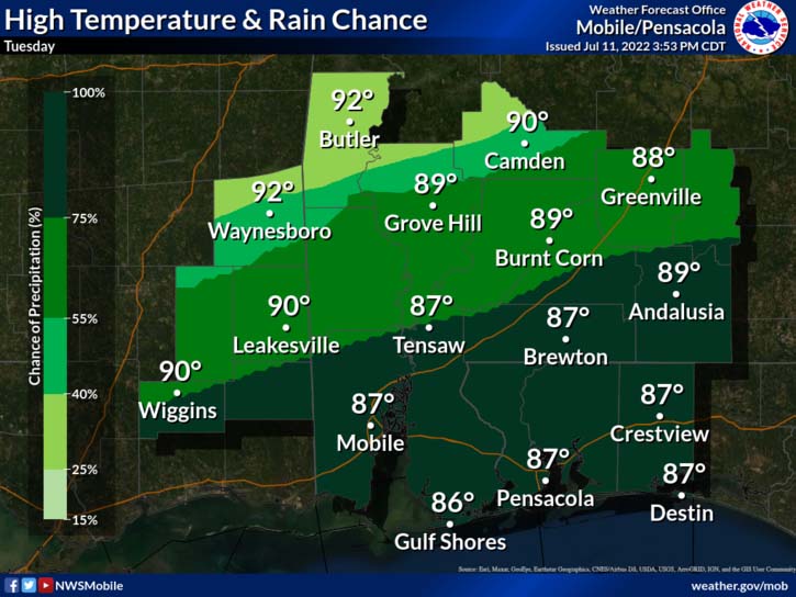
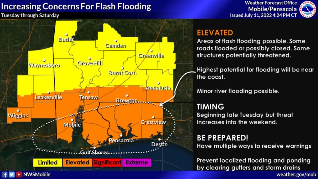
Heavy rains and flooding are possible with this system regardless of it becoming a named storm. Rain amounts are forecast in the 5-8 inch range.
Any storms that develop will have the potential for torrential rainfall with rates exceeding 2-3 inches per hour.
Storms will likely be slow moving and have potential to train over areas.
Rainfall totals might increase depending on what happens with the low pressure development, according to the NWS.
Unfortunately, the overall weather pattern will not change much for about five days or so, according to the NWS.
