Okaloosa County is included in a tornado watch in effect until 2 a.m. (National Weather Service)
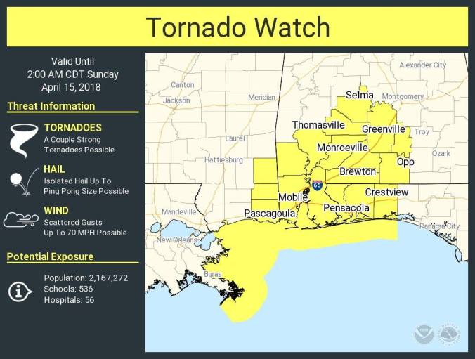
HOLT, Fla., April 14, 2018, 7:30 p.m.—The National Weather Service Storm Prediction Center has included Okaloosa County in a tornado watch.
The watch, which includes Escambia, Santa Rosa, Okaloosa and the western part of Walton counties, is in effect until 2 a.m.
The approaching system could produce a couple of strong tornadoes. According to the NWS, a “strong” tornado is an EF-2 or higher on the Enhanced Fujita Scale.
Isolated hail up to ping-pong-ball size is also possible.
According to the NWS, there remains a sufficient threat of significant severe storms with potential of damaging winds in excess of 70 mph.
An elevated risk of flooding rains is possible along and east of Interstate 65 in Alabama, tapering off by around or shortly after midnight.
As the cold front moves through overnight, the risk of severe weather ends in its wake, according to the NWS.
A small chance of lingering showers is possible here Sunday morning before ending.
Temperatures will turn cooler in the wake of the front with a high of 67 degrees Sunday, well below normal, according to the weather servie.
