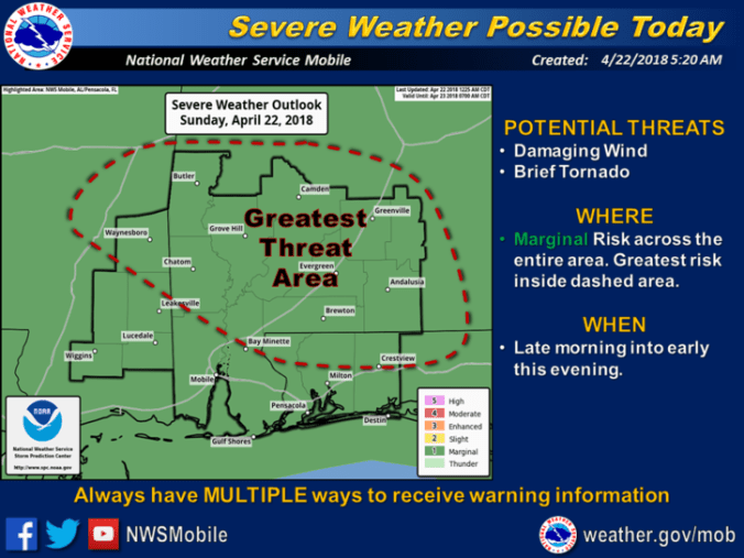
Holt and the surrounding community is included in the area of greatest threat of strong-to-severe thunderstorms today. (National Weather Service)
HOLT, Fla., April 22, 2018–Today’s forecasted rain could include thunderstorms and tornadoes, according to the National Weather Service in Mobile.
Showers and thunderstorms are expected to become numerous across the region today as a cold front approaches from the west.
The potential for a few strong-to-severe storms, and possibly even a brief/weak
tornado, could occur across portions of the forecast area this afternoon if the conditions are right, according to forecasters.
While there is a possibility for severe weather across the entire area today, the greatest risk for a few severe storms with damaging wind gusts and perhaps an isolated brief/weak tornado will be over interior southwest Alabama and inland portions of the western Florida panhandle, possibly including this area.
Timing for any strong-to-severe storms for these areas will likely be late morning through the afternoon hours.
Any heavy rainfall threat appears minimal due to the relatively fast west-to-east motion of the front across the area today and tonight.
Highs today will be near 74 degrees. Wind will be from the south around 15 mph with gusts as high as 20 mph.
For tonight, showers are likely with the possibly a thunderstorm before 1 a.m.
Lows should be around 60 with a south wind 5-to-15 mph with a 60 percent chance of rain.
National Weather Service forecast
