
The hurricane track has moved a bit back toward the west. (National Hurricane Center)
HOLT, Fla., Oct. 8, 2018—The Florida panhandle is under a hurricane watch as Tropical Storm Michael continues its move north.
 Michael is forecast to be near or at major hurricane strength when it reaches the northeastern Gulf of Mexico Tuesday night and Wednesday, according to the National Hurricane Center.
According to the local forecast for this area by the National Weather Service in Mobile, landfall will most likely occur Wednesday.
Dangerous impacts from wind, flooding and surge are likely across a portion of the northern Gulf Coast.
Impacts are dependent on the eventual track of Michael and adjustments to the forecast track are possible during the next couple of days, according to the NWS Mobile.
Michael is located about 680 miles south of Destin moving north at 7 mph with 70 mph winds.
The storm will continue to move north into the southeastern Gulf of Mexico today, potentially making landfall along portions of the Florida Panhandle as a hurricane Wednesday.
In addition to the hurricane watch, a storm surge watch is in effect from Navarre Beach eastward through Destin. Possible storm surge inundation between 2 and 4 feet will be possible in the watch area as the core of Michael moves inland along the coast of the Florida panhandle.
While Michael’s track and intensity are still uncertain, the threat for impacts have increased across much of the forecast area, according to the NWS Mobile.
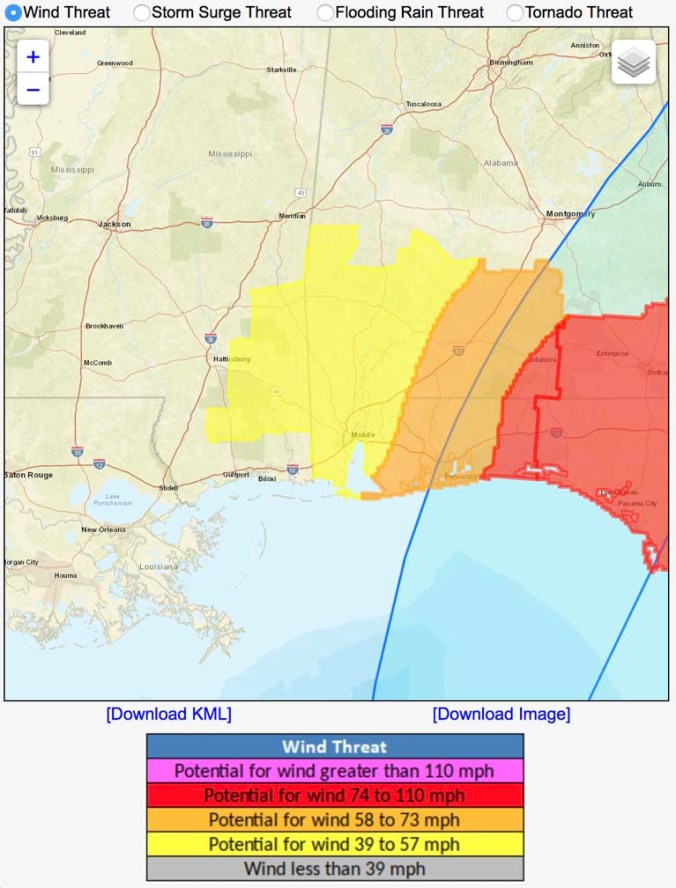 The NWS Mobile warns life-threatening wind having extensive impacts is possible across the western panhandle into portions of southeast Alabama.
Potential impacts in this area include:
- Considerable roof damage to sturdy buildings, with some having window, door, and garage door failures leading to structural damage. Mobile homes severely damaged, with some destroyed.
- Damage accentuated by airborne projectiles. Locations may be uninhabitable for weeks.
- Many large trees snapped or uprooted along with fences and roadway signs blown over
- Some roads impassable from large debris, and more within urban or heavily wooded places
- Large areas with power and communications outages
The next NHC hurricane advisory will be at 10 a.m. unless Tropical Storm Michael becomes a hurricane sooner.
