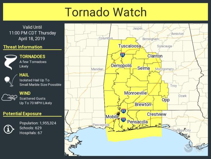
 HOLT, Fla., April 18, 2019 (4:45 p.m.)–The National Weather Service has issued a tornado watch for the entire forecast area.
This includes Okaloosa, Santa Rosa and Walton counties.
The watch is in effect until 11 p.m. tonight.
Strong-to-severe storm threat will be damaging winds with the possibility of a few tornadoes. A few tornadoes could be strong, according to the NWS.
“Tornadoes at night can be particularly dangerous because they are usually fast-moving and difficult to see,” according to a statement by the Storm Prediction Center. “Several tornadoes (a few significant) and scattered-to-widespread damaging winds are possible through tonight across the Lower Mississippi Valley and central Gulf Coast states.”
Additionally, this area is also under a wind advisory this afternoon until late tonight.
Southerly winds from 15-to-25 mph with gusts up to 35 mph are expected.
The Storm Prediction Center is forecasting straight-line winds in excess of 70 mph are possible with stronger thunderstorms associated with this system.
Light outdoor objects should be secured or stored indoors.
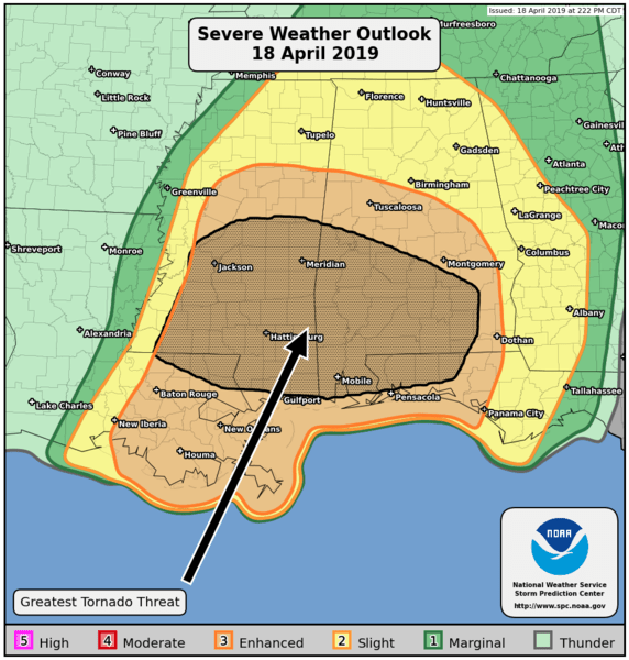
The brown highlighted area has the greatest possibility for tornadoes. This area includes Okaloosa, Santa Rosa, Walton and Escambia counties. (NOAA)
