 HOLT, Fla., Sept. 11, 2019—The National Hurricane Center continues to closely watch several areas.
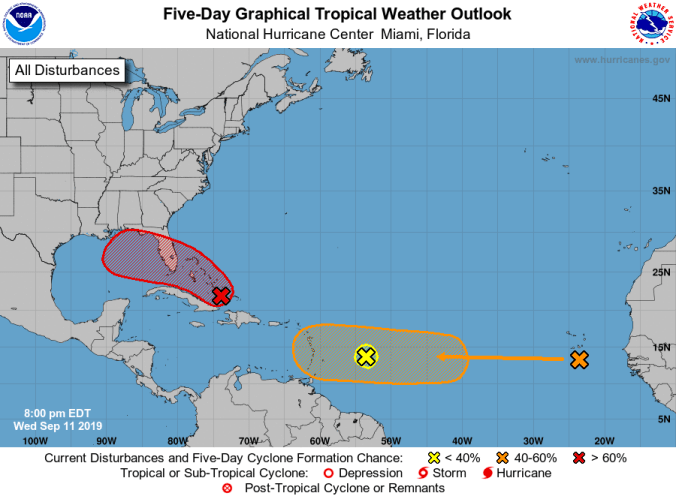
Widespread cloudiness and showers extend tonight from southeast Bahamas northward over the southwestern Atlantic for a few hundred miles associated with the low-pressure area identified as Invest 95.
Although limited development of this system is forecast tonight and Thursday, chances are now 70 percent as it encounters more favorable conditions during the weekend.
A tropical depression is likely to form as the system moves slowly toward the west-northwest across the Florida Straits and southeastern Florida and into the eastern Gulf of Mexico, according to the NHC.
This disturbance will likely produce periods of locally heavy rainfall and gusty winds across Florida during the weekend.
An Air Force Reserve reconnaissance aircraft is scheduled to investigate the system Thursday afternoon, if necessary.
The broad low-pressure system associated with a tropical wave located about 600 miles east of the Lesser Antilles has been gradually diminishing today, according to the NHC, and a tropical system is not anticipated.
However, the tropical wave located between the west coast of Africa and the Cabo Verde Islands is forecast to develop further during the weekend or next week as it moves quickly westward during the next several days.
Its chances have increased to 40 percent for the five-day forecast period.
National Hurricane Center forecast
