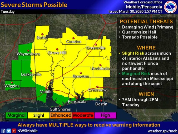
 HOLT, Fla., March 30, 2020—Potentially severe storms are forecast for Tuesday with damaging winds being the primary threat as a cold front moves through the region.
The National Weather Service forecasts the best chance for strong-to-severe thunderstorm activity will impact the Florida panhandle during the morning and early afternoon hours.
Damaging straight-line winds with hail and a few tornadoes are possible, according to the NWS.
Gusty southwest winds at 15-to-20 mph with 30 mph gusts are likely. As a result, this area is under a wind advisory beginning at 9 a.m. tomorrow morning through 7 p.m. tomorrow night.
Conditions are expected to improve quickly later in the day as the system moves out of the area, according to the NWS.
Clear skies will bring a low of 48 degrees Tuesday and Wednesday nights. Highs Wednesday and Thursday will be in the 70s.
