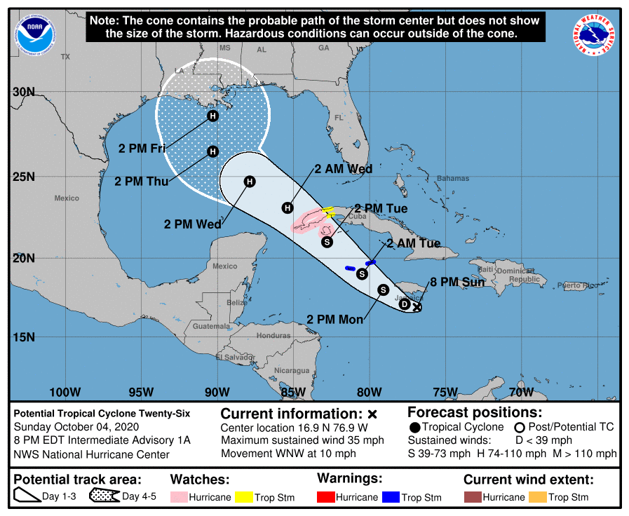
HOLT, Fla., Oct. 4, 2020—The National Hurricane Center is now identifying the tropical low in the Caribbean as Potential Tropical Cyclone 26.
PTC 26 is moving west-northwest near 10 mph with 35 mph winds over warm waters and in a moist environment, ingredients for potential strengthening.
The system is forecast to move into the southeastern Gulf of Mexico Tuesday night or early Wednesday.
The forecast calls for this system to become a depression or Tropical Storm Delta tonight or early tomorrow.

According to the NHC, strengthening is expected during the next few days and the system is forecast to be a tropical storm when it nears the Cayman Islands Monday and a hurricane when it moves near or over western Cuba Tuesday.
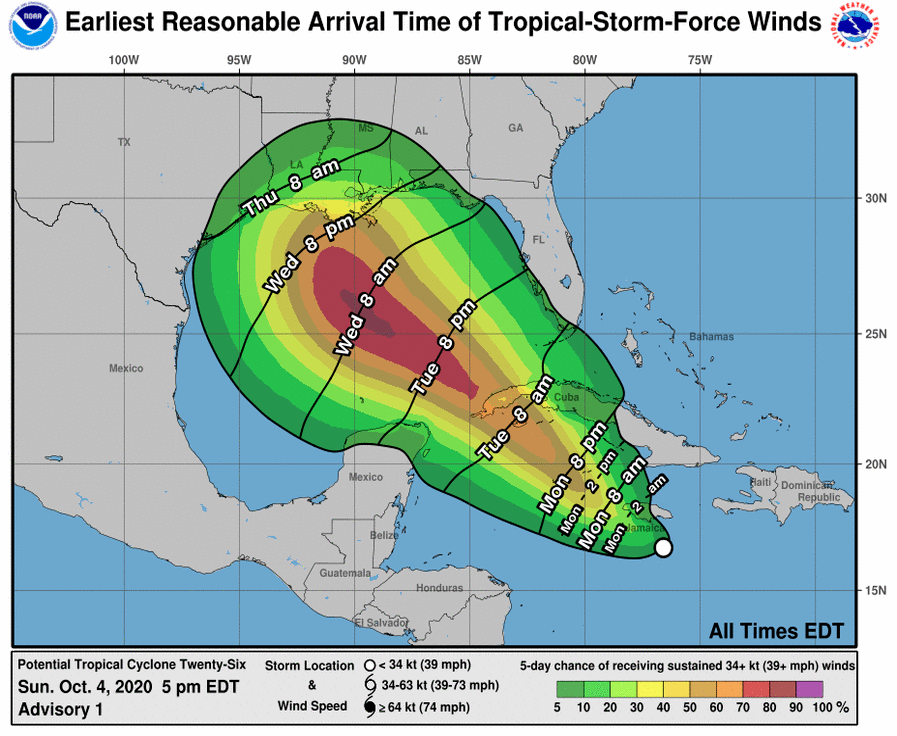
The system is forecast to approach the northern Gulf coast late this week as a hurricane.
While there is large uncertainty in the track and intensity forecasts at these time ranges, there is a risk of dangerous storm surge, wind and rainfall hazards along the coast from Louisiana to the western Florida Panhandle, according to the NHC.

Meanwhile, Tropical Storm Gamma will continue to meander offshore of the northern Yucatan Peninsula tonight and pass near or just offshore of the northern coast of the Yucatan Peninsula Monday and Tuesday, according to the NHC.
A turn toward the northwest is expected Thursday.
Maximum sustained winds are near 60 mph with higher gusts. Gradual weakening is anticipated to begin later tonight or Monday and continue into Tuesday.
Afterward, little change in strength is forecast.
National Hurricane Center forcasts
