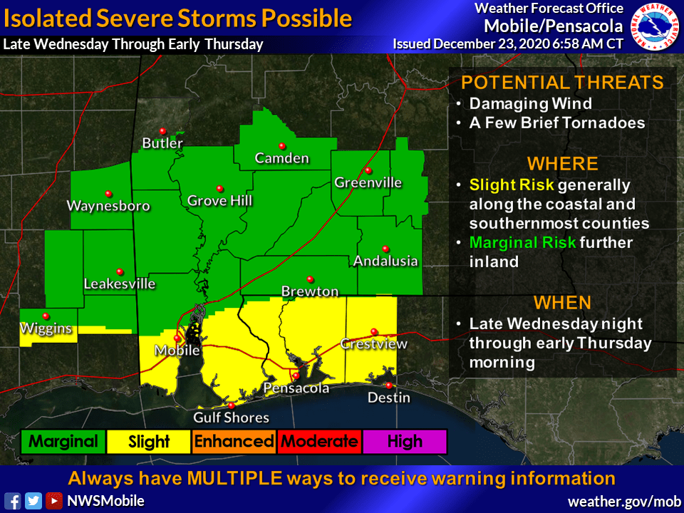
HOLT, Fla., Dec. 23, 3030—The National Weather Service in Mobile is calling for a risk of severe storms in the entire forecast area tonight into tomorrow morning.
A strong cold front will push across the region late tonight through tomorrow.
Ahead of the cold front, a line of showers and storms will form with isolated severe storms possible. The main hazard will be damaging winds, but a few tornadoes will also be possible during the pre-dawn and early morning hours Thursday.
The forecast is for rain to enter the region this evening across southeast Mississippi with the bulk of the rain spreading into the area through the overnight hours and into early Thursday ahead of the front.
Breezy conditions are expected tonight with gusty conditions tomorrow behind the front. According to the NWS, 20-to-30 mph winds with higher gusts are expected.
A wind advisory will likely be needed Thursday for parts of the area, according to the NWS. Winds could lead to downed trees and broken tree limbs, especially across areas that sustained significant damage earlier this year during Hurricanes Sally and Zeta.

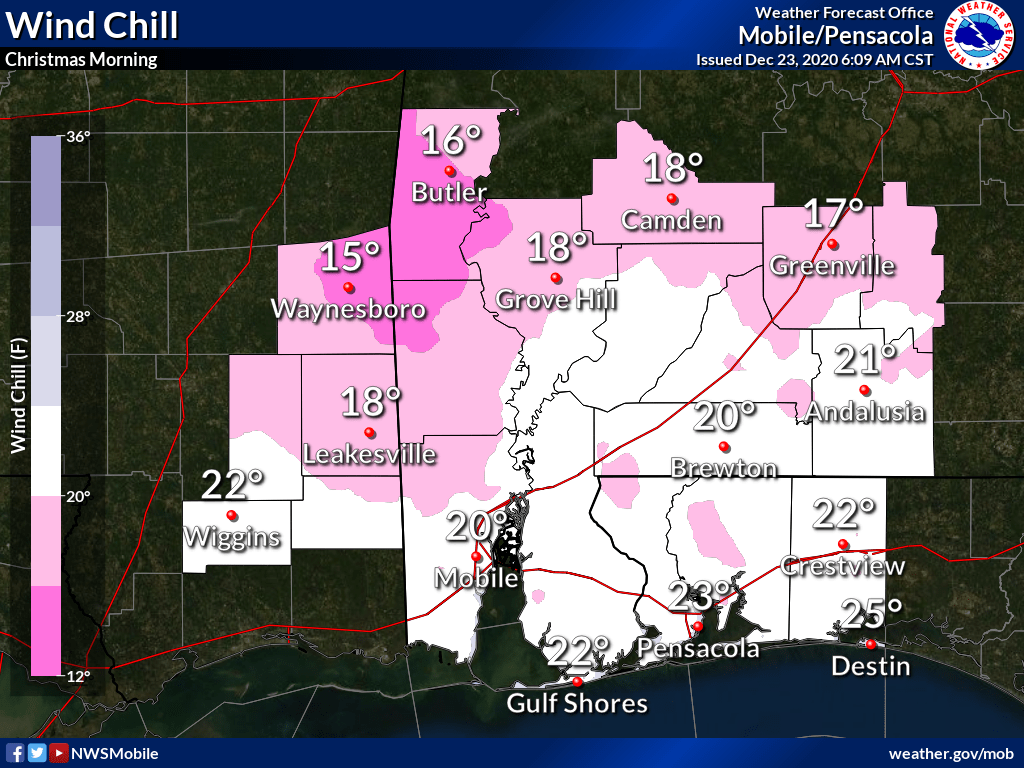
For Christmas, temperatures will plummet into the 20s. Wind chill will cause the temps to dip into the teens to low 20s Christmas morning.
Daytime temps will struggle to reach into the 40s Christmas Day, according to the NWS.
National Weather Service forecast
