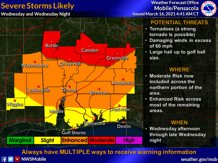
HOLT, Fla., March 15, 2021—The severe storm risk is increasing for Wednesday as an advancing cold front collides with a large area of warm low pressure, according to the National Weather Service.
“The greatest concern is the severe weather potential Wednesday afternoon into Wednesday night,” the NWS stated on its Facebook page.
Tornadoes, southerly damaging winds in excess of 60 mph, golf-ball-size hail and locally heavy rains are possible. A strong tornado—EF2 or EF3—is also possible, according to the NWS.
The greatest risk for severe weather is along and north of a track along Interstate 65 in Alabama, according to meteorologists. However, tornadoes are possible outside of that specific risk area.
Timing for this area will likely be late afternoon into Wednesday night and lasting into early Thursday morning hours, according to the forecast, with the core of the threat between 3 p.m. to 3 a.m. Storms could last to just before daybreak.
The NWS will continue to refine the forecast during the next 24 hours.
Cooler, drier air will continue through the weekend with a slight warming trend, according to the forecast. Temps will be in the mid-40s for lows and mid-60s for highs.

