HOLT, Fla., March 31, 2021—A strong cold front is expected to bring the possibility of more unsettled weather today according to the National Weather Service.
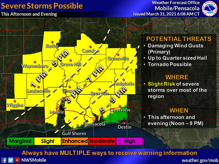
Because of the potential for numerous showers and thunderstorms, the NWS has placed almost the entire forecast area under a level 2 risk (out of 5) for severe storm activity.
According to the NWS, a few storms will be capable of producing damaging wind gusts in excess of 60 mph–a primary threat–with the potential for hail up to quarter size.
Heavy rainfall could approach 2 or more inches per hour with some storms. A tornado cannot be entirely ruled out for some areas, according to the NWS.
A wind advisory has been issued for the entire forecast area from 4 to 7 p.m. Northerly winds will increase to 15-to-25 mph with gusts up to around 40 mph expected behind the front, according to the NWS.
Breezy northerly winds will continue through Thursday afternoon.
Timing for any severe weather for this area is between 5 and 9 p.m.
Behind the cold front, skies will clear leaving nighttime lows in the 30s tomorrow and Friday, and in the 40s for Saturday and Sunday. Daytime highs will be in the 60s and 70s with clear skies.
