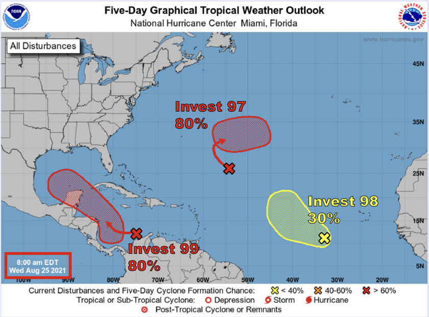
HOLT, Fla., Aug. 25, 2021—A new tropical depression is likely to form in the Caribbean Sea by this weekend.
According to the National Hurricane Center, a broad area of low pressure is expected to form over the southwestern Caribbean during the next day or so.
Now identified as Invest 99, this low is likely to develop into a tropical depression or potential tropical cyclone late this week or this weekend.
Conditions in the northwestern Caribbean—80-plus degree waters, low wind shear, high atmospheric moisture—are favorable for development, according to the NHC.
Invest 99 is forecast to move west-northwest near or across the Yucatan Peninsula Saturday and move into the western Gulf of Mexico by Sunday where favorable conditions will increase additional development chances.
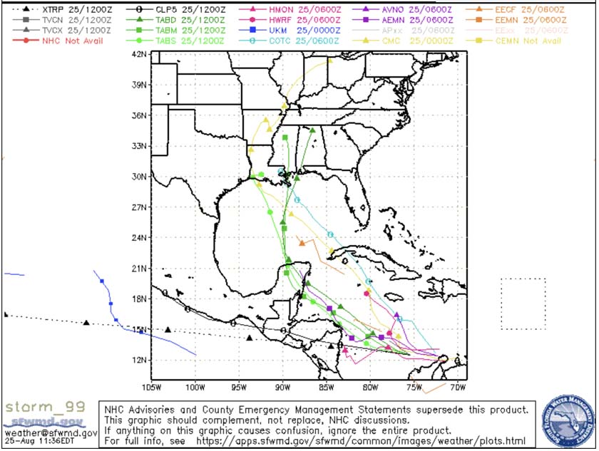
According to the National Weather Service in Mobile, early morning weather modeling indicates strengthening of the system and moving it up toward the Louisiana-Texas border area by late Monday.
For now it appears that this system will remain west of the forecast area, as models highlight the western half of the Gulf, according to the NWS.
There is much uncertainty at this time however, as the system has yet to develop a trackable low level circulation, according to the NWS.
Should a tropical storm form, the next name on the list is Ida.
Invests 97 and 98
Meanwhile in the Atlantic Ocean, Invests 97 and 98 are not expected to pose a threat to Florida or the United States, at least for now.
Invest 98 is still a tropical wave moving over the far eastern Atlantic.
Some development is possible during the next several days; however, upper-level winds are forecast to become less favorable by this weekend, according to the NHC.
In the central Atlantic 800 miles southeast of Bermuda, Invest 97’s development will be slow for the next day or so because of strong upper-level winds.
However, conditions become more favorable later this week into the weekend, and a tropical depression is likely to form.
Modeling shows this system will turn eastward over the central Atlantic, away from the United States.
