HOLT, Fla., Feb. 16, 2022—Today’s partly sunny skies will cloud over tomorrow as a cold front approaches bringing rain and possible thunderstorms.
Rain tomorrow is expected after noon with a south 10-20 mph wind gusting as high as 35 mph.
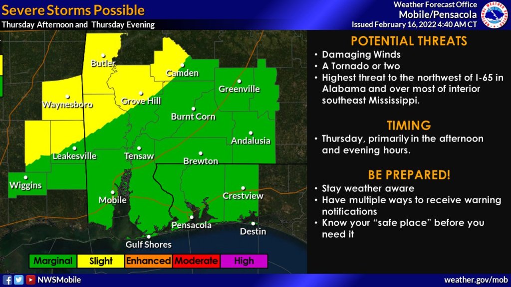
According to the National Weather Service, primary weather threats include damaging winds with a possible tornado.
Tomorrow’s thunderstorm activity puts this area in a Level 1 storm risk zone with the best chance for damaging wind gusts or a tornado occurring mainly north and west of Interstate 65.
Timing of these storms will be from tomorrow afternoon into Friday early morning hours with the primary window between 5 p.m. to midnight.
The 70 percent chance of rain tomorrow increases to 90 percent tomorrow night, then decreases after midnight leaving mostly sunny skies Friday with a high of 65.
The weekend will be sunny and clear with high temperatures in the 60s and lows in the 30s.
Monday’s Presidents Day holiday is forecast to be partly sunny with a 30 percent chance of showers and thunderstorms and a high near 71 degrees.
