HOLT, Fla., May 25, 2022—Heavy rain is in the forecast for the rest of today and into tomorrow.
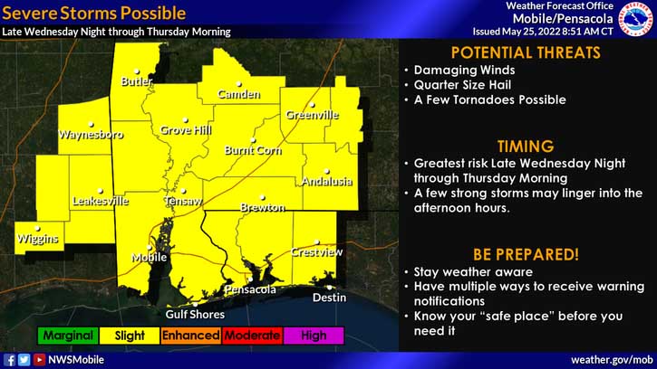
The severe storm threat for this area has been elevated to a level 2 out of 5 as a result of anticipated thunderstorm activity.
The National Weather Service says isolated severe storms are possible today with a slightly more organized threat of severe weather developing across the area late tonight into Thursday morning.
Damaging winds, hail up to at least quarter size and a few tornadoes will all be possible severe hazards through Thursday, according to the NWS.
Around 6 a.m., radar indicated a tornado in Escambia County north of Pensacola heading toward Pace. It changed into straight-line winds which overturned several trees in the area.
For the rest of the day today and into tomorrow, multiple rounds of showers and storms will move across the area, according to the NWS.
Widespread rainfall amounts of 3-5″ with locally higher totals are forecast across much of the western Florida Panhandle where areas of flash flooding will be possible.
A Flash flood watch is in effect until 7 p.m. tomorrow.
Staff and NWS forecast
