
HOLT, Fla., Nov. 26, 2022—Northwest Florida is included in a low-end severe weather risk zone beginning tonight through tomorrow morning.
Showers and storms are forecast for the local area this evening. Severe storms for this area are possible as early as 7 p.m. through 4 a.m. tomorrow.
Additionally, localized damaging winds and a tornado or two are possible, according to the National Weather Service in Mobile.
One to two inches of rain is expected with this storm system.
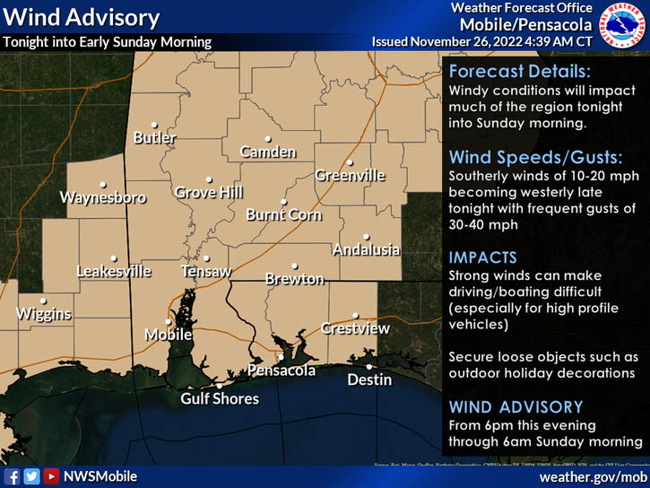
Gusty winds are forecast tonight into early Sunday morning across the region. As a result, a wind advisory is in effect tonight beginning at 6 p.m. through 6 a.m. tomorrow.
Sustained 10 to 20 mph winds will occasionally gust upwards of 40 mph after sunset tonight through sunrise Sunday morning.
The NWS recommends securing loose objects such as outdoor holiday decorations which could easily be blown around. Strong, gusty winds may also lead to hazardous driving conditions for high-profile vehicles.
Clear skies are forecast behind the storm system with sun and a high of 70 tomorrow and a low of 49 degrees tomorrow night.
Rain chances roll around again Tuesday and Wednesday.
Staff and NWS forecast
