HOLT, Fla., Dec. 13, 2022—Another round of severe weather is forecast for tomorrow.
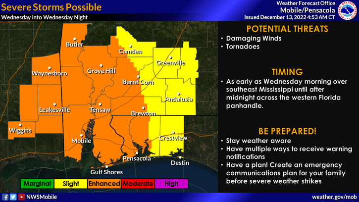
This morning’s forecast puts this area in a level 2 out of 5 risk zone ahead of a cold front moving across the area late tomorrow afternoon through tomorrow night.
According to the National Weather Service in Mobile, storms could start as early as mid-morning in areas east and continue here after midnight.
The main threats are damaging straight-line winds, hail, a few tornadoes and localized heavy rainfall.
The system bringing severe weather is part of the large system moving coast to coast causing dangerous blizzard conditions in the Great Plains and icy weather in the upper Midwest.
Above-seasonal temperatures are expected through tomorrow night before the cold front moves cooler and drier air into the area.
Highs Thursday through the weekend are forecast to be in the low 60s to high 50s with lows Thursday, Friday and Saturday night in the upper 30s.
