HOLT, Fla., Jan. 22, 2023—The National Weather Service is forecasting the possibility of more severe weather tomorrow.
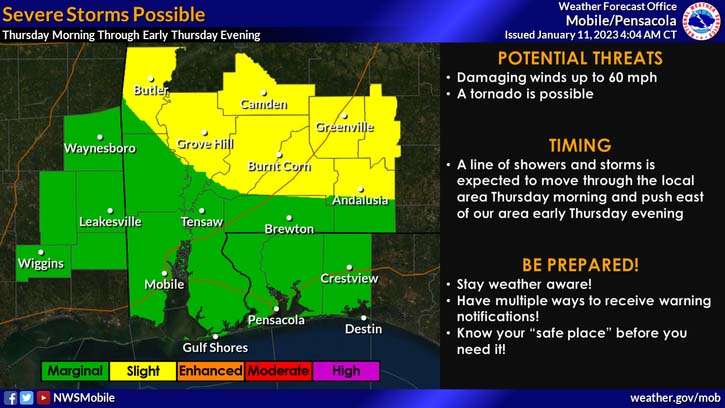
A line of strong-to-severe storms is expected to move through the local area tomorrow morning into the evening bringing the potential for damaging winds up to 60 mph and possibly a tornado, according to the NWS.
This area is in a level 1 out of 5 severe weather risk zone. The heavier activity is forecast for areas north in southern Alabama.
The primary threat will be wind gusts with the stronger storms with a squall line moving through the area, according to the NWS.
Highs today and tomorrow will be in the low-to-mid 70s. Above-seasonal temperatures continue tonight and tomorrow ahead of the front, dropping to below-seasonal after.
Low temperatures tonight in the low 60s drop into the mid 40s tomorrow night.
Drier and colder conditions will take hold over the region through the weekend, according to the NWS.
Looking ahead
Temperatures will start out chilly, then gradually warm through the period.
High temperatures Friday and Saturday will struggle to warm past the 50s, but by Tuesday, highs will top out in the mid 70s here.
Temperatures are expected to drop into the high 50s Monday night.
Warmer temperatures and rain chances return early next week.
National Weather Service forecast
