HOLT, Fla., April 4, 2024—Another round of severe weather ahead of a cold front is forecast Sunday as the system moves through the area.
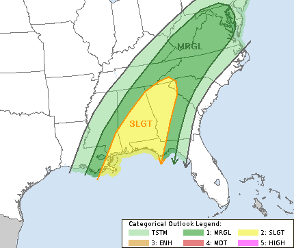
For now, the Storm Prediction Center has identified a level 2 out of 5 risk for severe weather here Sunday.
The stationary system that’s been spawning tornadoes and dumping once-in-a-century amounts of flooding rain over the Midwest and southern states to the west will finally move through the Mobile forecast area Saturday night bringing the chances of damaging winds and possible tornadoes.
Timing is still to be determined; however this will likely be a daytime event by the time the system reaches Okaloosa County.
The National Weather Service is forecasting more of a heavy rain threat. That said, a few isolated severe storms with damaging winds and maybe a tornado or two will be possible. Furthermore, if a severe threat were to materialize, it would likely be east of Interstate 65 in Alabama around the noon hour Sunday, according to forecasters.
Behind the storms, overnight temperatures will drop into the mid-to-low 40s Monday night through Wednesday night with highs in the mid 70s during that timeframe.
