 HOLT, Fla., May 23, 2019—The forecast for this weekend is hot and sunny.
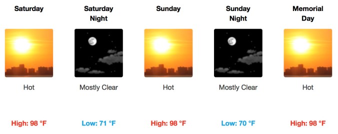
While the central plains states get a 1-2-3 punch of severe thunderstorms and tornadoes, this area will be seeing above-normal temperatures for the Memorial Day weekend.
A strong high-pressure system is centered over the southeast bringing mostly sunny to partly cloudy skies today.
Temperatures, as much as 10 degrees above normal, will reach 90-to-95 degrees by early afternoon.
This warming could set conditions for afternoon scattered thunderstorms to develop; however, none are expected to be severe, if they do occur, according to the National Weather Service.
Possible gusty 40 mph winds and brief heavy rainfall could occur with any pop-up storms.
Expect mostly clear skies and temperatures climbing into the high 90s with some locations topping 100 degrees tomorrow and heat index approaching 105.
Sunday and Monday will be the hottest days of the holiday weekend, according to the NWS with a heat index of 105.
