 HOLT, Fla., April 17, 2020—Another round of severe weather may be in store for the weekend according to the National Weather Service.
Clouds will continue to increase across the area with rain showers possible by this evening.
Highs will top out in the 70s. Lows will be warmer this evening due to increased moisture and cloud cover.
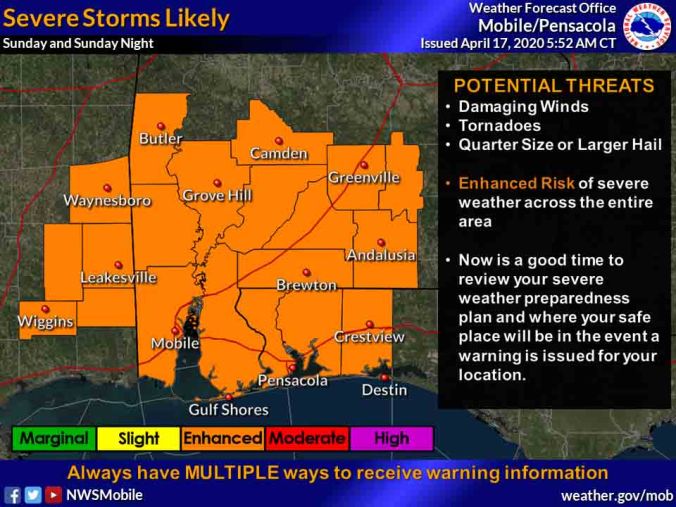
Sunday morning through Sunday night, strong-to-severe storms are likely again Sunday with the best chance occurring during the afternoon-to-evening timeframe.
The main threat will be strong wind, quarter-size hail or larger, and possibly tornadoes.
In addition to the severe weather risk, multiple rounds of showers and storms spreading over the region will bring potential for heavy rainfall.
Forecast details about the timing and areas affected by this system may change between now and Sunday, according to the NWs.
NWS forecast
