 HOLT, Fla., June 5, 2020—The western Florida panhandle is now under a tropical storm warning.
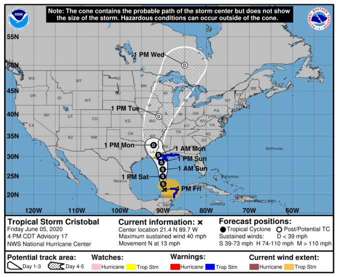
The National Hurricane Center issued tropical storm warnings from Morgan City, La., to the Okaloosa/Walton county line.
Cristobal re-strengthened into a tropical storm before moving back over the Gulf of Mexico waters earlier today.
 The storm is moving north near 13 mph and is expected to move over the central Gulf waters tomorrow and be near the Gulf coast Sunday.
Although the storm will be traveling over fairly warm waters during the next couple of days, dry air and some shear is expected to limit Cristobal’s intensification, according to the NHC.
 Forecast strength is 60 mph winds by landfall.
Landfall is expected in Louisiana late Sunday or early Monday.
Tropical storm force winds are expected by late tomorrow night.
Impacts
Rainfall amounts between 4 and 6 inches is possible with periods of heavy rainfall, especially in areas to the west.
Isolated tornadoes will also be possible within rain bands Sunday through Sunday night.
Dangerously high surf is likely with breaker heights of 8-to-11 feet developing late Saturday night through Monday afternoon, according to the National Weather Service in Mobile.
Coastal flooding is possible along Alabama and the western Florida panhandle with inundation of 2-to-3 feet Sunday through Monday afternoon, especially around the time of high tide.
