
HOLT, Fla., Sept. 13, 2020—The northwest Florida panhandle is now under a tropical storm warning.
Tropical Storm Sally is forecast to become a hurricane tomorrow and strengthen into a category 2 storm prior to landfall Tuesday along the Louisiana/Mississippi coast, according to the National Hurricane Center.
Rapid intensification of the storm is possible close to landfall, according to the NHC.
The storm is forecast to slow as it approaches the Gulf coast, increasing the chances for prolonged periods of heavy rain, damaging wind and the possibility of tornadoes.
Because this area is located on the unstable eastern side of the storm, severe weather here is likely.
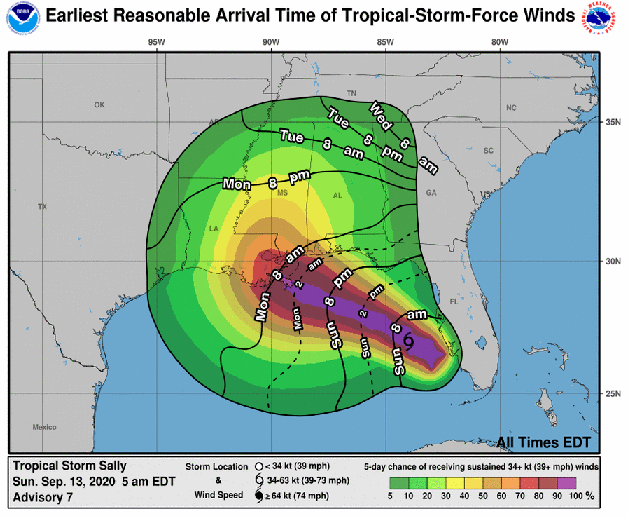
Tropical-storm-force winds extend outward up to 90 miles from the center of the storm.
This system is expected to bring extended periods of heavy rains Tuesday and Wednesday with amounts of 6-to-8 inches in this area with locally higher amounts, according to the National Weather Service in Mobile.
Tropical-storm-force winds are likely through much of the western Florida panhandle. According to the NWS, if the storm takes a more eastward track than currently forecast, then hurricane-force winds would be possible.
A few tornadoes, located in the outer bands of the storm, mainly across the western Florida panhandle, are also possible beginning as early as tomorrow, with the greatest risk occurring Tuesday into Wednesday as Sally makes its way inland.
National Hurricane Center forecast
