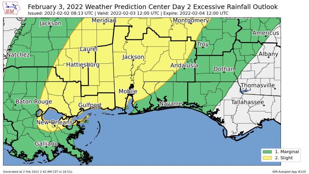
HOLT, Fla., Feb. 2, 2022—Isolated severe thunderstorms are possible tomorrow as a cold front approaches from the northwest.
The National Weather Service’s Storm Prediction Center has put this area under a Level 1 risk for severe weather threat.
Main threats tomorrow afternoon through tomorrow night will be from damaging winds with the potential for a tornado during the evening hours, according to the National Weather Service in Mobile.
While the bulk of the severe weather will be in areas to the west in the Mississippi and Alabama, some heavy rains and gusty winds are expected in this area as well.
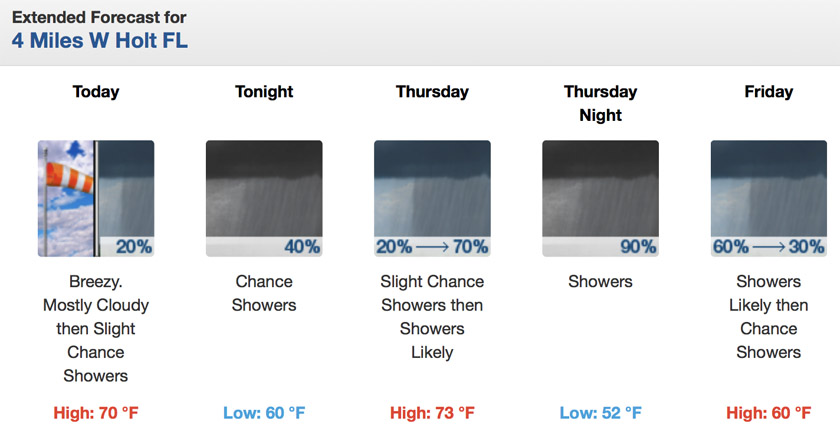
Scattered showers are forecast for this afternoon with rain chances increasing tonight into tomorrow morning.
Expect today to be mostly cloudy with scattered showers and breezy with 15-25 mph winds and gusts as high as 30 mph.
It will be mostly cloudy tonight with a chance of showers. Winds will be from the southeast at 10 to 15 with gusts up to 20 mph.
Showers and thunderstorms are possible tomorrow with a higher risk of severe weather in the afternoon to evening timeframe. Wind shifts to the south around 15 mph with gusts as high as 30.
Showers and thunderstorms continue into tomorrow night with winds 10 to 15 mph shifting to the west after midnight. Gusts could get as high as 25 mph.
