
HOLT, Fla., Oct. 17, 2022—This week brings a little bit of everything except tropical weather as the end of the hurricane season gets closer to Nov. 30.
A dense fog advisory is in effect today until 10 a.m., according to the National Weather Service in Mobile.
Visibility in some areas this morning was reduced to 1/4 mile or less.
The best chance for rain is today, but only at 20 percent. There are no other rain possibilities in the seven-day forecast.
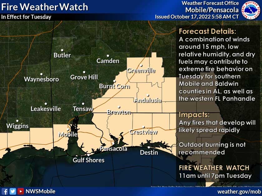
A fire weather watch is in effect for tomorrow from 11 a.m. until 7 p.m. due to a combination of winds around 15 mph, low relative humidity and dry conditions.
Any fires that develop will likely spread rapidly, according to the NWS.
Because of this, outdoor burning is not recommended.
Finally, due to a cold front moving through tomorrow night, the entire forecast area will be under a freeze watch from 1-8 a.m. as the first widespread freeze of the season is possible for all areas except the immediate coast.
The NWS is expecting record lows with many areas recording their earliest freeze on record.
Temperatures here are forecast to be near freezing. Highs Wednesday will be in the mid-60s.
Cold temperatures will remain in the low-to-mid 30s through Thursday night.

Darn, I have one more word to add to the alliteration
LikeLike