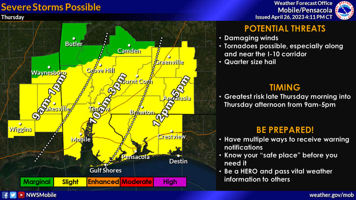
HOLT, Fla., April 26, 2023—The National Weather Service is forecasting an active weather day for tomorrow.
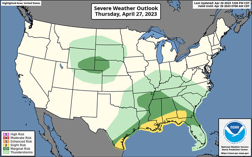
The NWS’s Storm Prediction Center has placed the Florida panhandle and areas north under a level two risk for severe thunderstorms with the greatest risk being between noon to 5 p.m. for this area.
Main threats are damaging winds, tornadoes generally along and south of the Interstate 10 corridor and quarter-size hail.
Southeast wind 10 to 15 mph are forecast to shift to the southwest in the afternoon with wind gusts up to 20 mph associated with the storms.
Coastal areas to the south could experience flash flooding from heavy rains, according to the NWS.
Rain chances continue through Sunday, clearing off Sunday night with lows in the mid-to-low 50s through Tuesday.