
Severe weather is expected to reach this area during the early hours of Sunday. (National Weather Service in Mobile)
HOLT, Fla., April 12, 2019—A line of potentially severe storms will move eastward through the area Saturday night into midday Sunday.
According to the National Weather Service in Mobile, the main threats in any severe storm will be damaging winds and perhaps a few tornadoes.
While not in the enhanced risk area, further extension of the enhanced risk may be needed in future updates as well as adjusted timing of the storms’ estimated arrival.
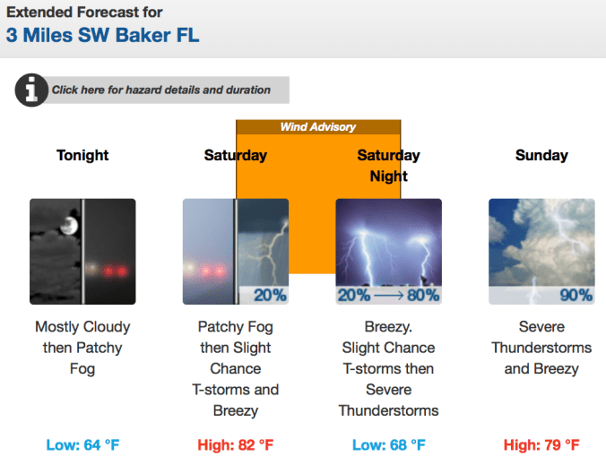
Additionally, a wind advisory is in effect from noon Saturday to 1 a.m. Sunday with southeast-to-south winds at 15-to-25 mph and frequents gusts up to 30 mph.
Saturday’s forecast is for mostly cloudy skies with a high near 82 degrees.
Showers and thunderstorms are expected to roll in mainly after 1 a.m. Sunday morning. Some storms could be severe and produce heavy rainfall.
Rains continue throughout the day Sunday evening with mostly clear skies Sunday night and a low around 47 degrees.
National Weather Service forecast
