HOLT, Fla., June 18, 2026—Okaloosa County has received 1-3 inches or more of rain in the past 48 hours thanks to slow-moving remnants of Tropical Storm Arthur.
A flash flood warning is in effect for Pace, Milton, Crestview and Baker until 8:15 p.m.
Yesterday’s rainfall totals were 6-8 inches across the county. Another 5-7 inches of rain is possible here within the next 40 hours or so. More than 15 inches of rain is possible before this event is done, according to the National Weather Service in Mobile.
River levels are expected to crest during the Saturday-Sunday timeframe. Residents and campers living in low-lying flood-prone areas especially along the Yellow and Shoal Rivers need to be aware of the potential for quickly rising waters.
A flood watch remains in effect for the entire western panhandle until 6 p.m. tomorrow.
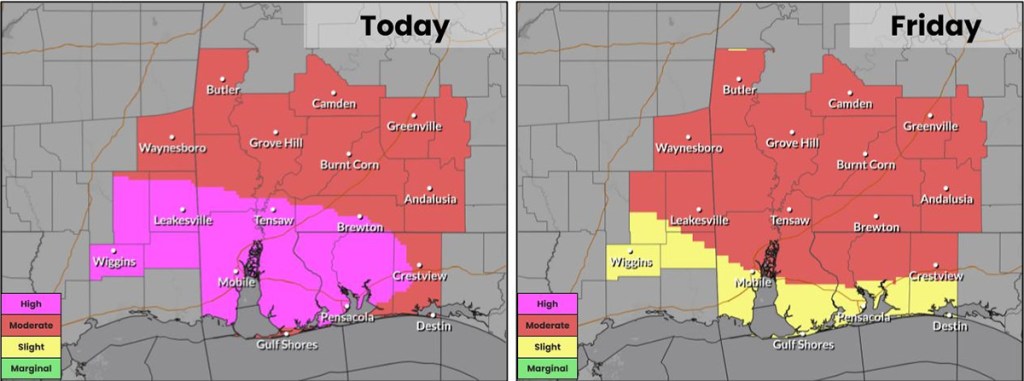
The Weather Prediction Center issued a rare “high” risk (level 4 out of 4) of flash flooding for the western areas of Okaloosa County. Tomorrow’s flash flood forecast puts this area at a level 3 risk.
Additionally, more rain is in the forecast for Saturday and Sunday as a cold front moves through the area.
The tornado risk has diminished, but is not zero. The tornado watch for Okaloosa County has expired.
